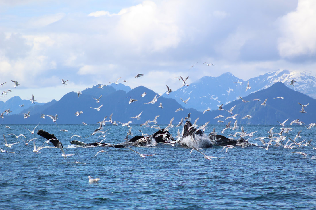
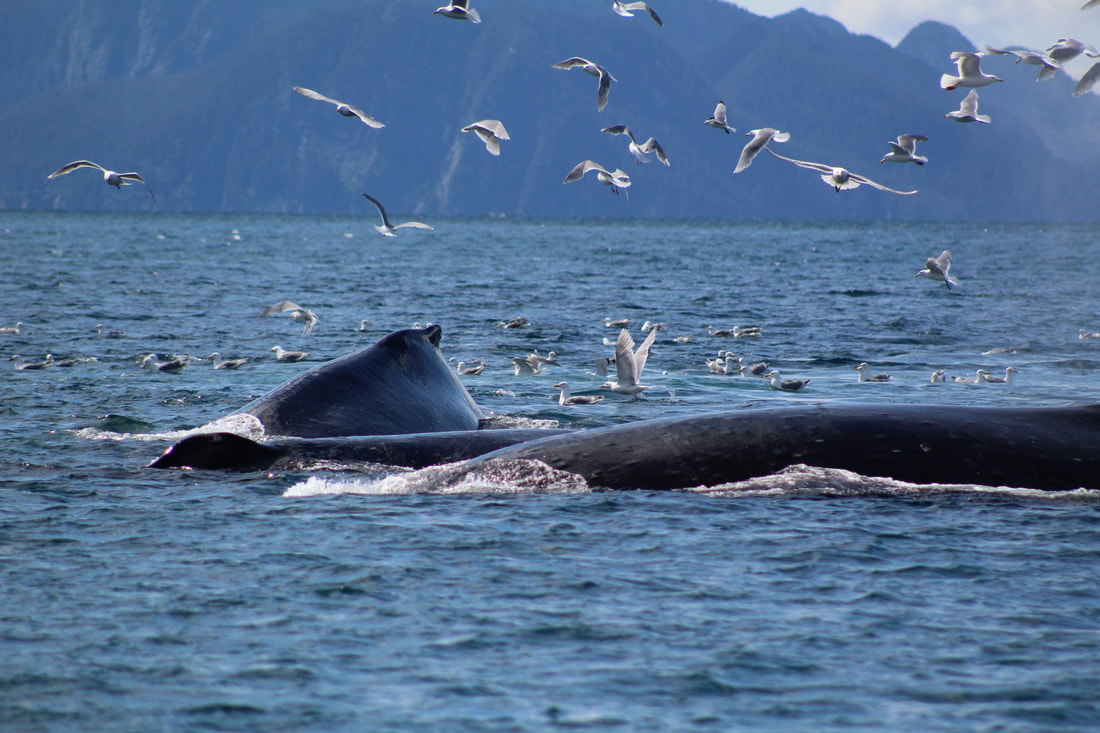
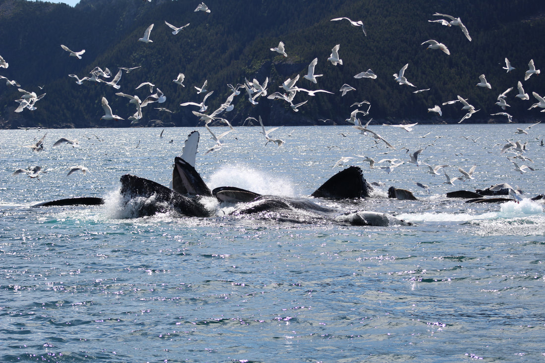
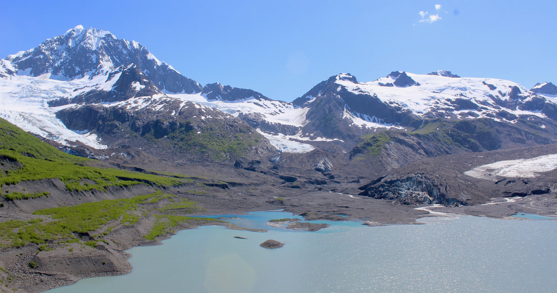
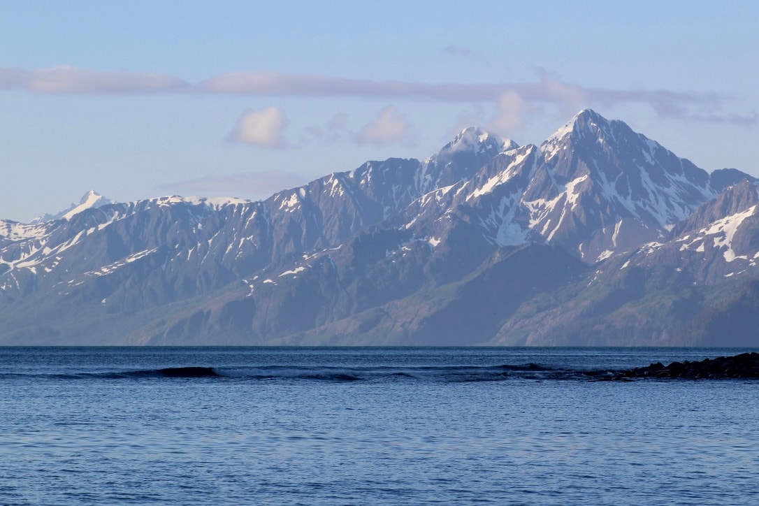
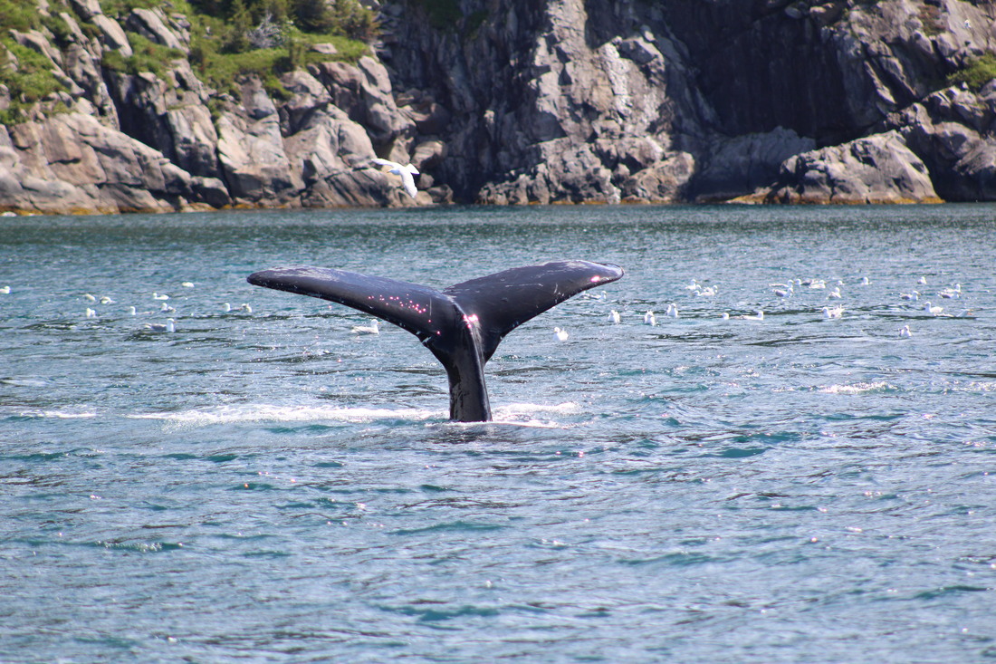
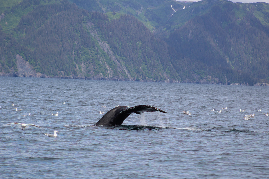
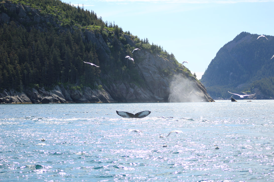
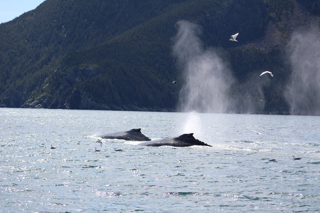
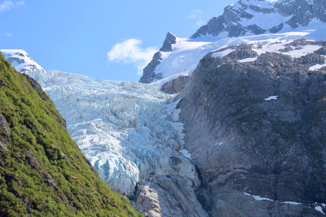
 Excerpts from the log: 20 June 2020 1145 Depart Sunny Cove, Fox Island 1730 Cape Aialik 2135 At anchor in Coleman Bay What a day! Slow start after a long day yesterday, but we were rewarded with our leisurely departure. Woke up to a pattering noise on deck and burst out laughing when a duck came into view standing on the clear hatch over the vee berth. Once underway from Sunny Cove we could see lots of gull activity off Hive Island. As we motor-sailed closer we saw enormous dark shapes emerging from the frothing water - humpback whales bubble-net feeding! There were probably eight or nine whales working together to feed using the incredible technique. The whales swim in circles at depth and exhale bubbles of air. These bubbles rise towards the surface and expand to form a curtain of air that traps small fish and krill. The whales swim up through concentrated prey with their mouths wide open. They burst through the surface, close their mouths to trap the fish and krill, and strain the extra seawater out through their baleen before swallowing their catch. 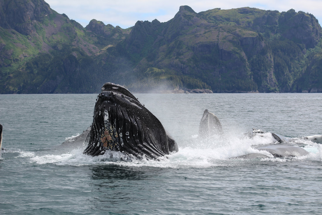 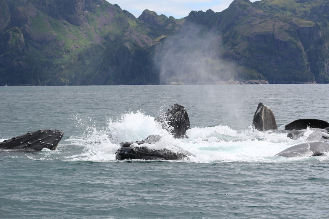
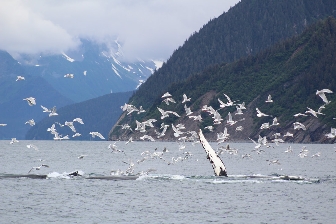 We cut the engine near the northwest corner of Hive and enjoyed the silence as we drifted and waited. But it wasn't quiet for long! The whales were deep below the surface and their calls were resonating and being amplified by the hull of our sailboat. Amazing. These calls allow them to communicate and coordinate their bubbling and lunging as a group. There was a pattern: lots of individual trumpet-like calls were followed by a prolonged, high-pitched call by a single whale that appeared to signal the group's ascent to the surface to capture the fish they had corralled. The first time the whales broke through the surface with their mouths wide open they were only a few boat lengths away - sure surprised us! We drifted and watched while the humpbacks continued feeding nearby, taking photos and listening to their calls through the boat's hull and over the hydrophone. We used this underwater microphone to make some recordings of this groups bubble-net feeding calls - the same trumpeting followed by a single prolonged call. There were only a few smaller boats around, and most had shut down their engines to watch, so there was minimal sound interference and background noise. 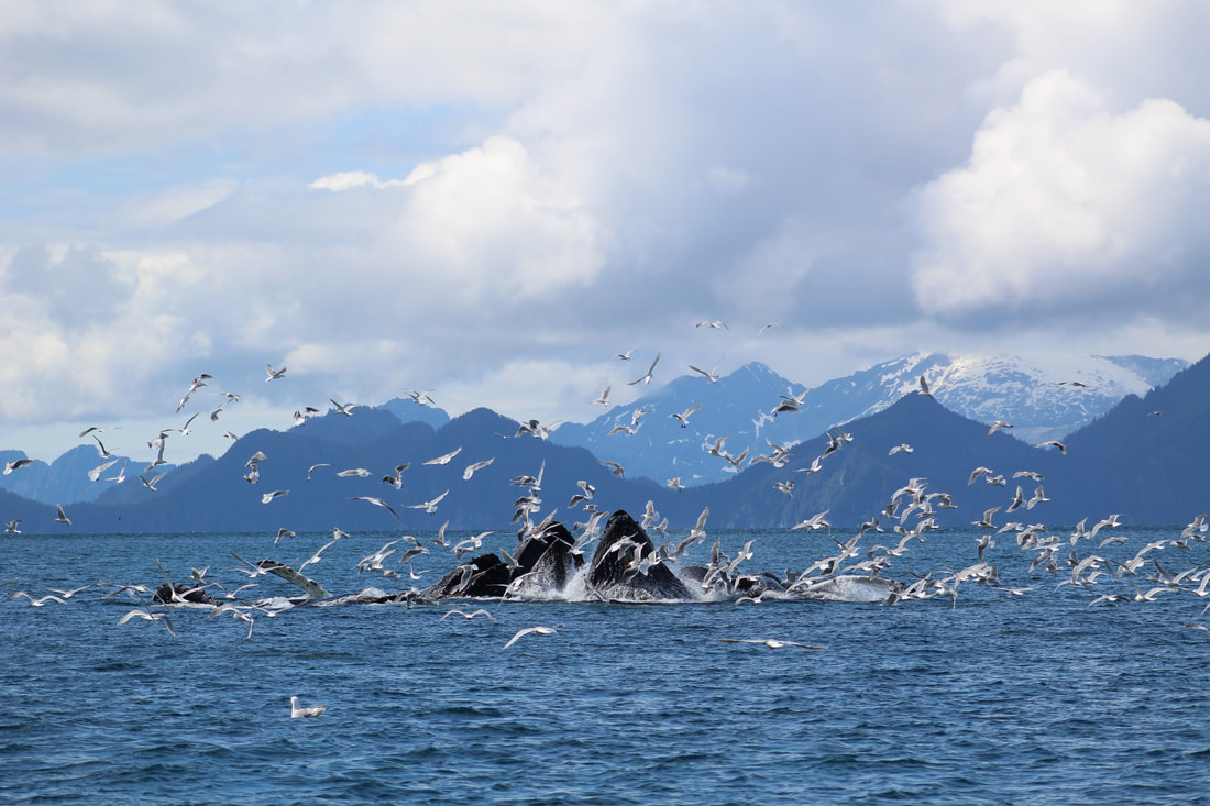 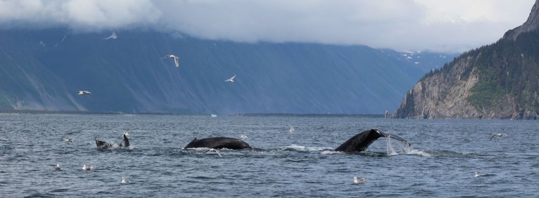
  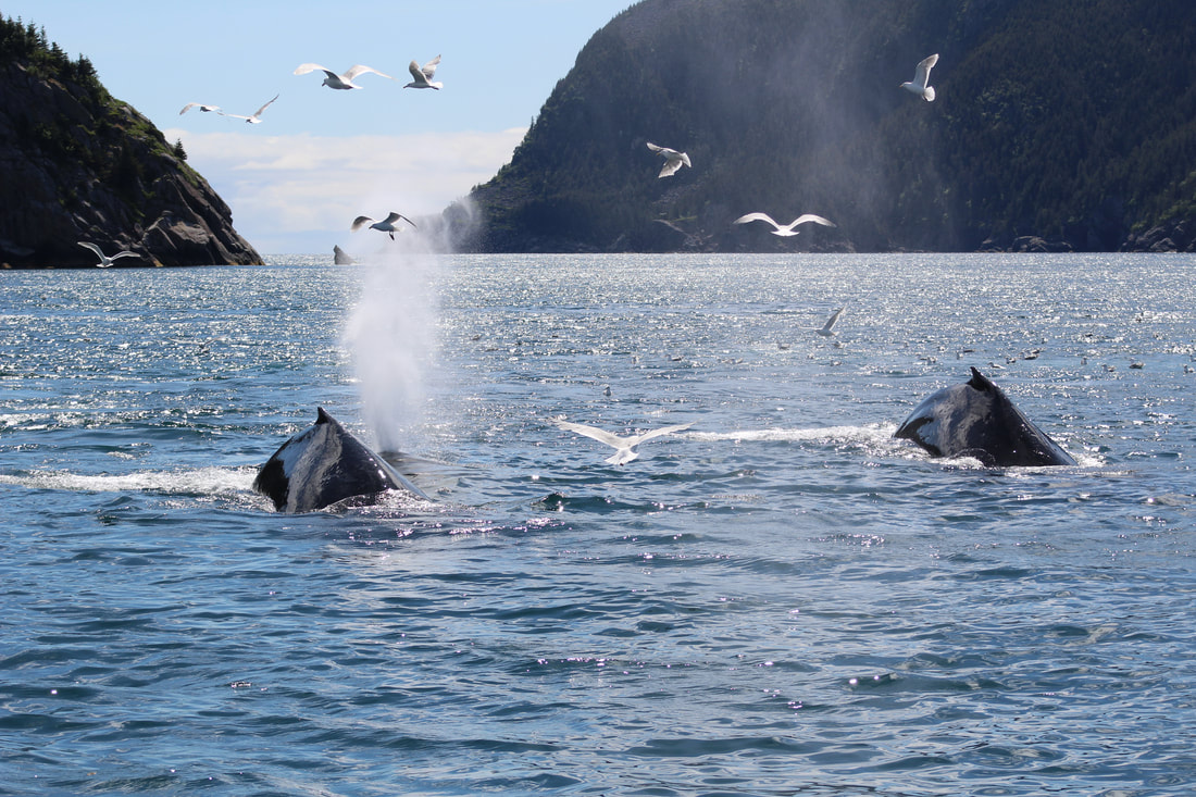  The humpbacks continued to work the coastline and we set our mainsail to parallel their course towards the south. It was so quiet under sail, an incredible experience to observe them feeding as we glided along. It was also lovely to see friends on some of the small whale watching boats, and they excitedly shared that a film crew onboard got some great video footage of the scene.
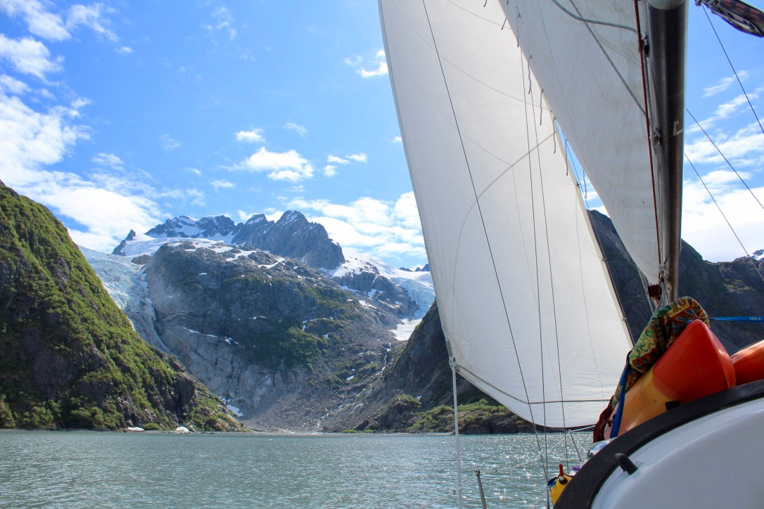
After a while, we set the genoa and pointed towards Cheval. We sailed all the way there on a single port tack before the wind died as we neared the Cape. Lovely golden evening light on the cliffs of No Name Island. Gentle swells around the Cape, so we stopped and caught a black rockfish on the first cast - dinner! Probably in the 6-8 lb range, a good size for this species. Brent filleted the fish as we sailed north into Aialik Bay. Graying skies and increasing clouds signaled a front moving in, with east winds blowing more forcefully out of the coves along the Aialik Peninsula. We made it to Tooth Cove before the peninsula blocked most of the wind and we had to start the engine. On our way into Coleman Bay we saw a small zodiac and said hello to the National Park Service folks onboard (who Brent worked with last summer) as they were heading back to the ranger station. We dropped anchor in Coleman Bay and immediately enjoyed a hot yellow curry with fresh rockfish and veggies that Brent had prepared while I was on the helm for the final stretch. Some wind gusts over the ridge through the evening, but overall feeling full and fulfilled after a stellar day on the water.
0 Comments
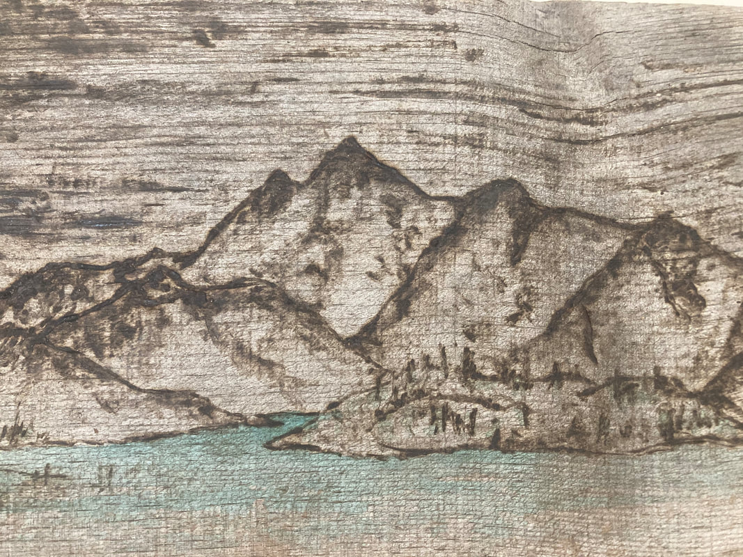
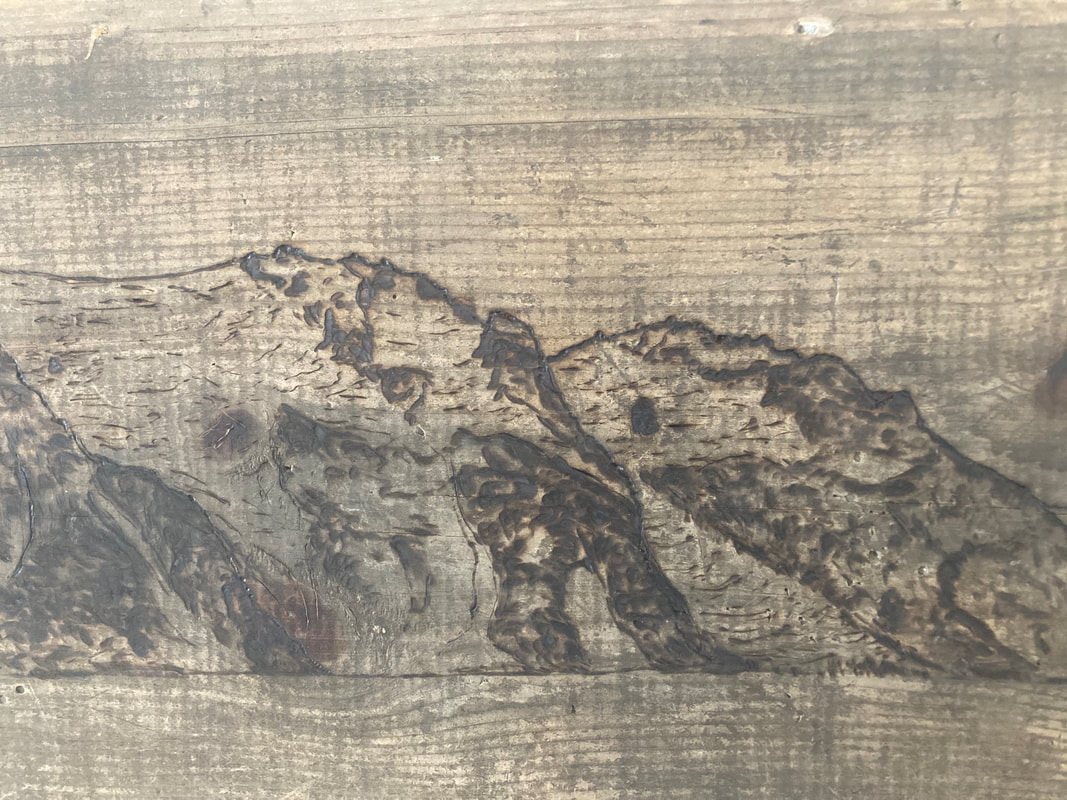
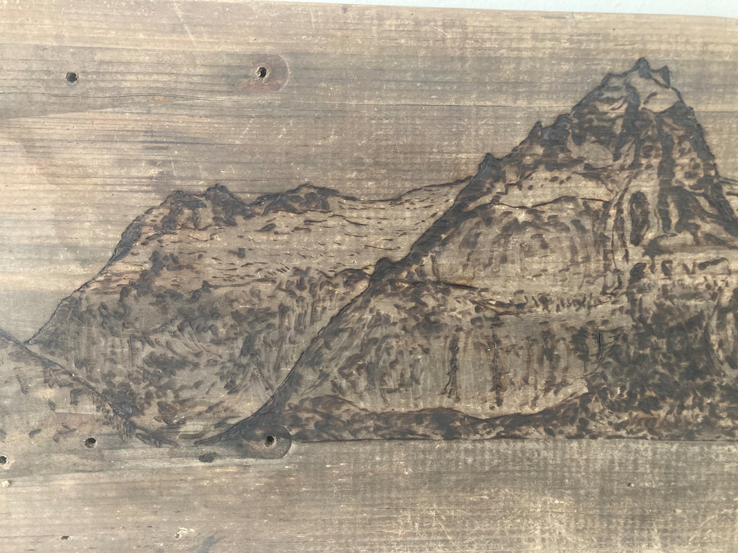
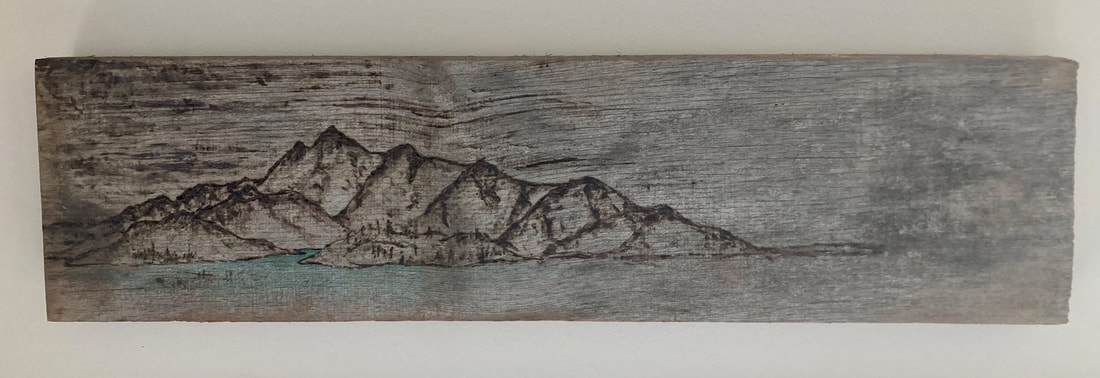 Northwestern Woodburning - North (Brent Pikolas)
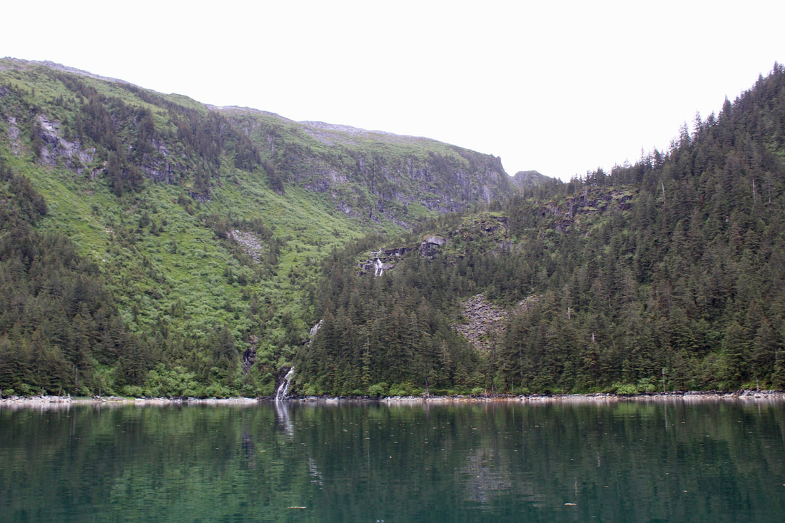
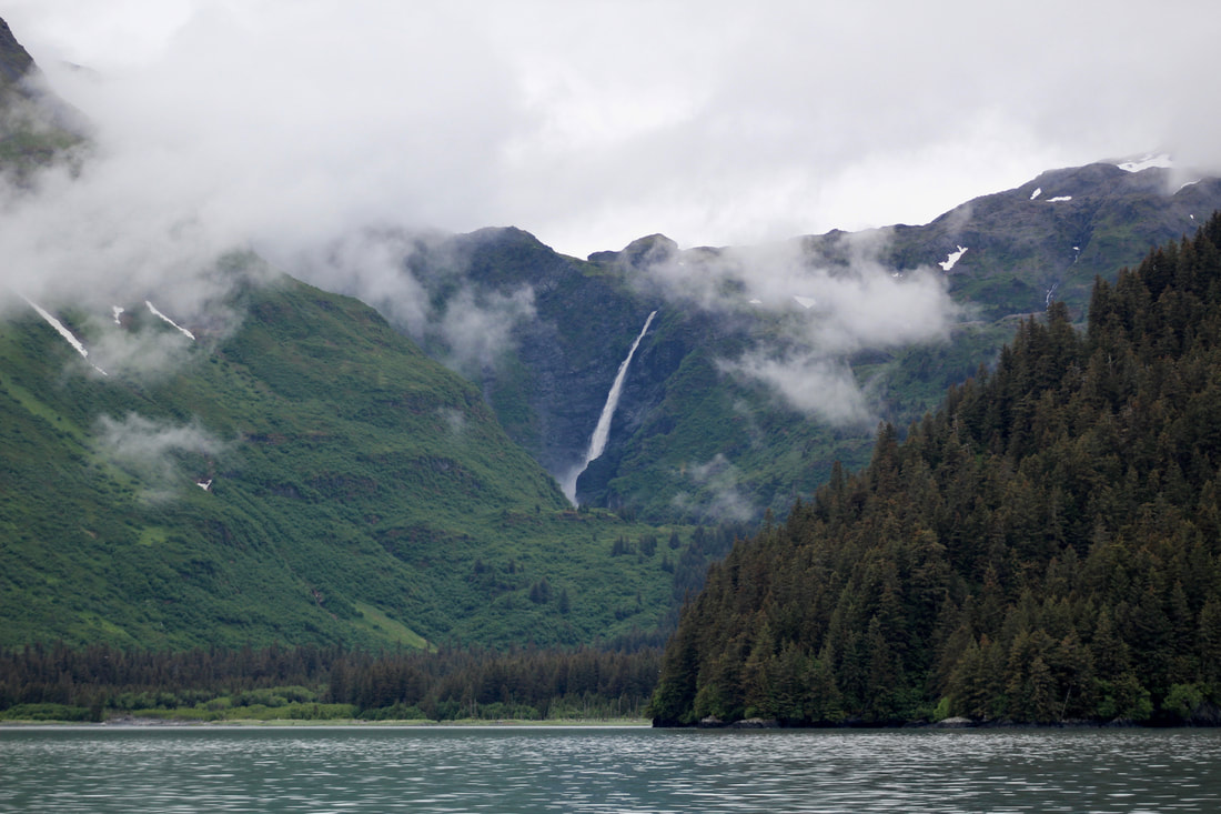 The 900-foot Kvasnikoff Falls, fully charged with rain after the storm. After the gale... excerpts from the log: 18 June 2020 1300 Depart Pilot Harbor 1530 Harrington Point 2000 At anchor, Midnight Cove Relaxing morning, aside from the fact that the forecast is calling for another round of east wind and 17-foot seas in a few days. Seventeen!? That's winter storm height, ugh. It's still far out, but better to reposition ourselves to be closer to town in case it ramps up or comes closer to the coast. If it's a typo it will hopefully be caught before we're too far along! Pulled up very muddy ground tackle with mud squashed in every link. The wire mousing on the anchor shackle had even broken but remained in place! All that swinging around during the storm definitely put some stress on our gear but that's why we put so much effort into maintaining it and backing up the various components. Our 22 lb Bruce anchor with 100 feet of 5/16 chain and 250 feet of line in the water definitely held us in place! Motored out into the North Arm of Nuka. Glass calm with soft, low, wispy clouds clinging to the spruce trees - love these days! Great views of the 900 ft Kvasnikoff Falls, extra charged with rain from the storm. Lush vegetation everywhere, hills and mountains more gently sloping than the fjords to the east. Looks like bear paradise! Around Quartz Bay we began to feel the residual swell wrapping into the bay.  Mist hanging low in the valleys, framing our views of the glaciers. After trolling for salmon under sail on our way east from Harrington Point (nothing caught, but still a good time), we passed through the narrow entrance from Moonlight Bay into Midnight Cove. Lots of freshwater from the waterfall creating a murkey brackish layer where the fresh water and salt water mixed. Lots of current with the tidal change too - fun watching jellies zooming past and capturing underwater footage of bull kelp streaming by. We found a nice spot to anchor and had a quick dinner. Some of our onions were starting to go bad, so I made a large batch of escabeche (pickled onions, carrots, and jalapeños) and made the whole boat smell - delicious, and strongly - like vinegar and onions. Midnight Cove Taqueria! Soft rain in the late evening. Amazing to have hardly any wind. The forecast is still calling for 17 foot seas in a few days.
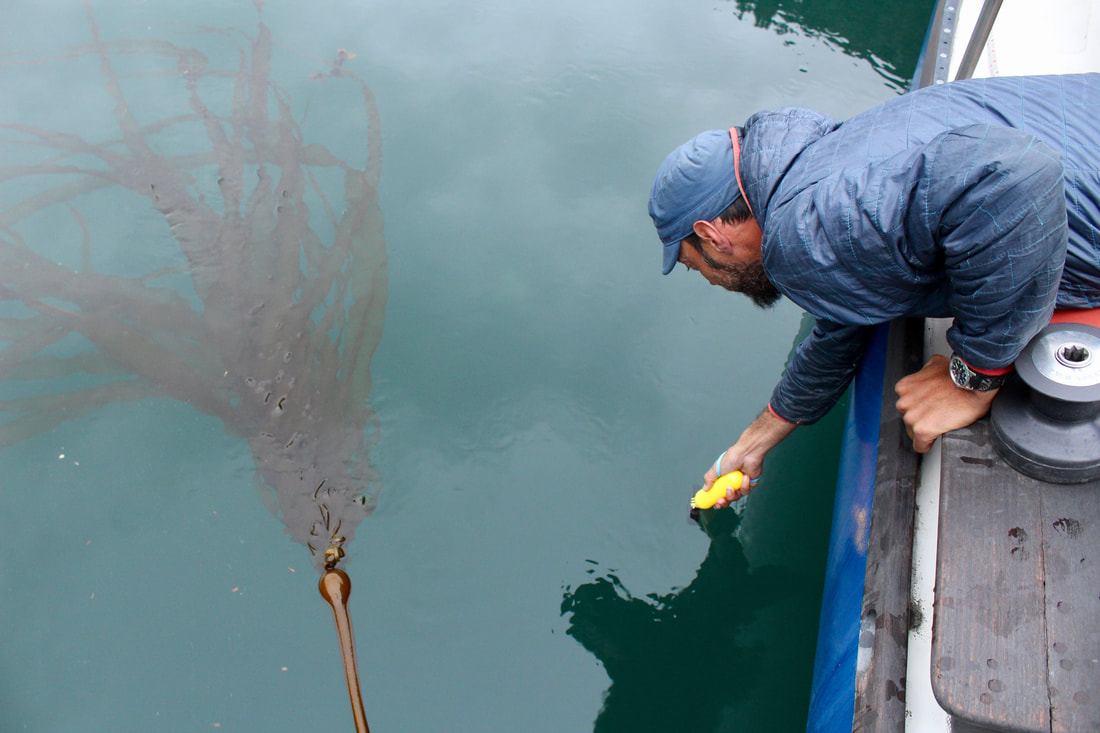
19 June 2020 0515 Depart Midnight Cove 0650 McArthur Pass 1430 Pete's Pass 1530 Off Cape Aialik 1930 At anchor, Sunny Cove This morning the updated forecast still calling for seas 17 feet in the near future, and paired with strong east winds. We decided to go as far as we could towards town today. Up very early to haul back, wonderful sticky and stinky mud on the chain and anchor! Lots of life going on down there. Motored in the calm of the early morning down to McArthur Pass. Got there just in time too - water was beginning to push westward just on the other side of the narrows, even though the tide was technically ebbing for another half hour. There's a lot of complex bathymetry around here, and in narrow passages that link very large and different areas it's difficult to predict exactly what the water will be doing at a particular time. There are no current tables for this stretch of coastline. The only way to know is to go and have a look! When we crossed that current line the bow pulled hard to port, but I was able to correct her quickly. It was a little like running a river rapid, but in a sailboat. Fast way to get your heart galloping early in the morning! 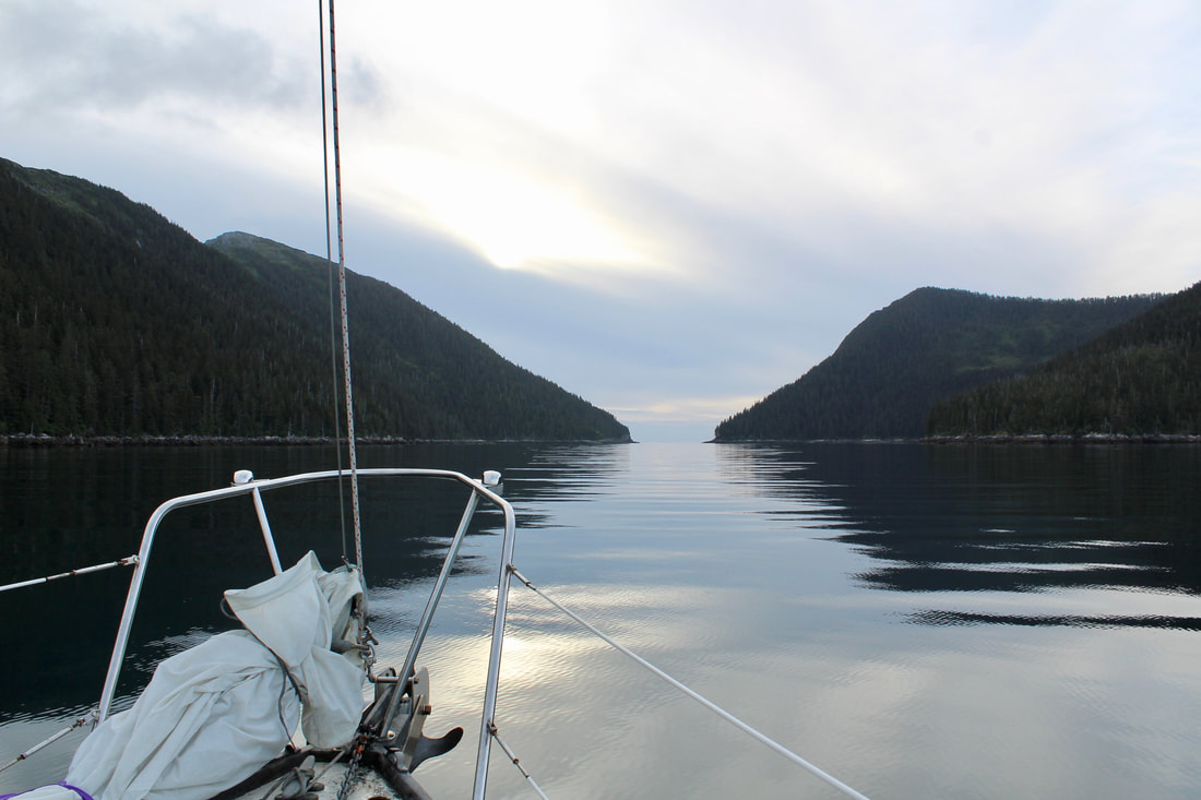 Early morning transit through McArthur Pass. 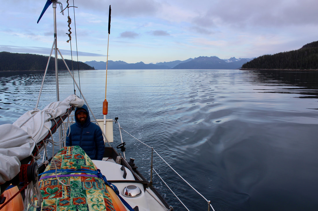 Early morning transit through McArthur Pass. We took turns on the helm as we motored toward the southern tip of Granite Island. It's a good stretch of water to cross (about 20 nm) so the silhouette of Granite Island barely seemed to get closer as the Pye Islands fell away behind us. Long period swells left over from the last storm made things a bit rolly, but Katabatic handled them gracefully. Later in the morning the wind picked up a little so we set sail and inched along, but the swells were large enough that we had trouble keeping the sails full in the light breeze.
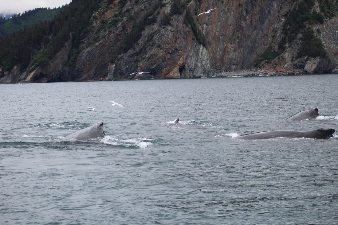
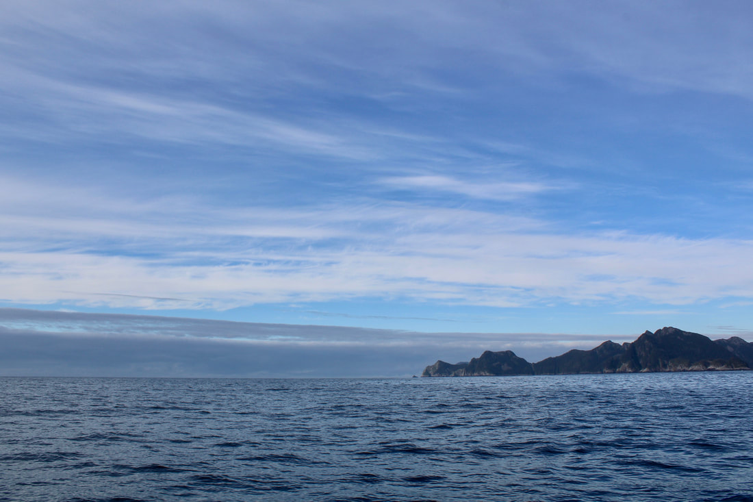
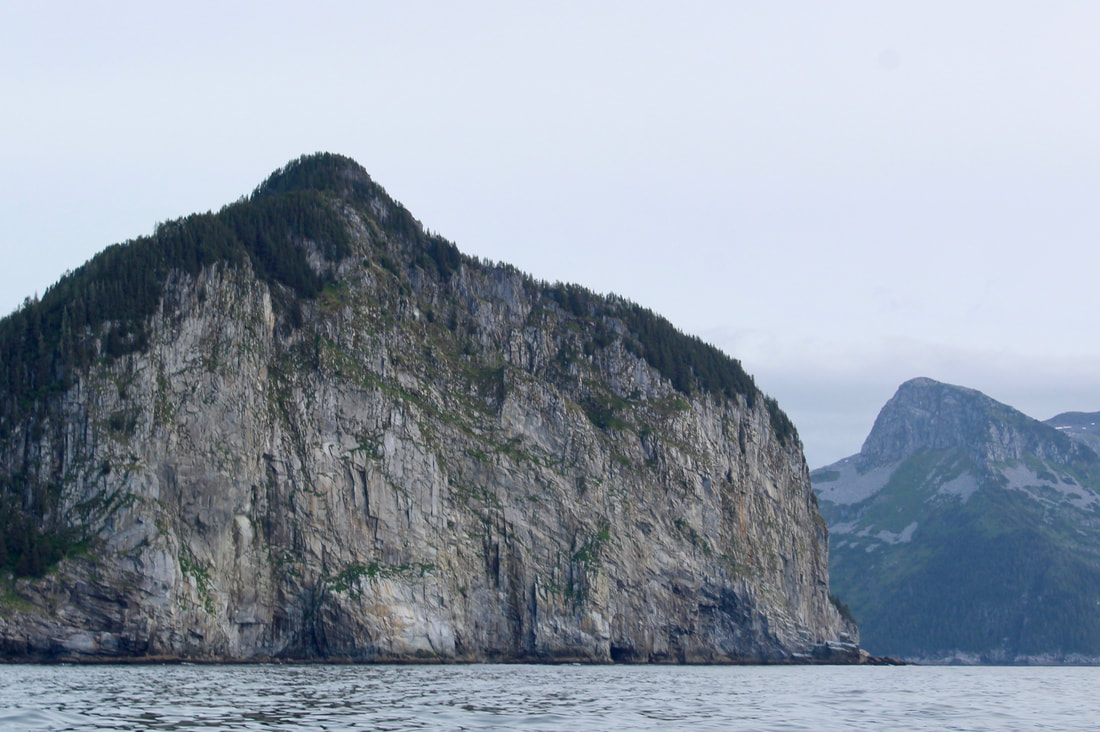
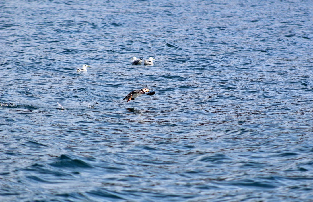
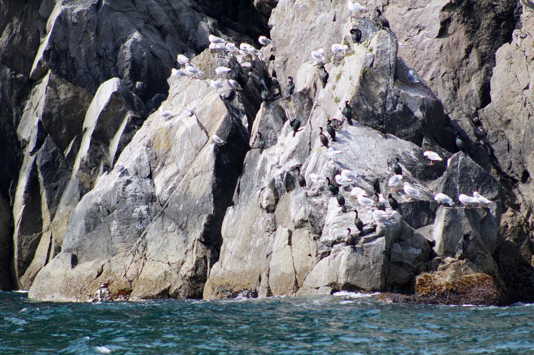
In the afternoon we travelled through the Chiswell Islands via Pete's Pass with several humpback whales and lots of feeding seabirds. This group of islands is part of the Alaska Maritime National Wildlife Refuge that protects the breeding and feeding grounds of many types of marine mammals and birds. We tried our luck trolling for salmon just east of Pete's Pass, but the only catching was done by the horned puffins, pigeon guillemots, cormorants, and black-legged kittiwakes fishing for small forage fish. 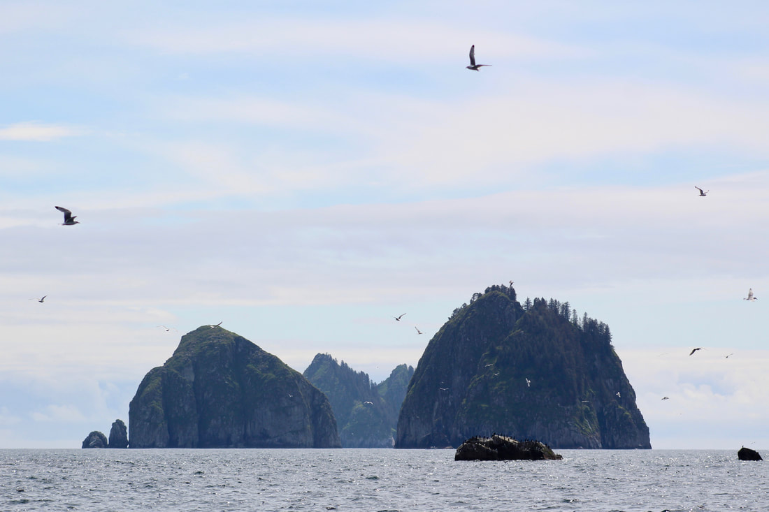 The Beehive Islands!
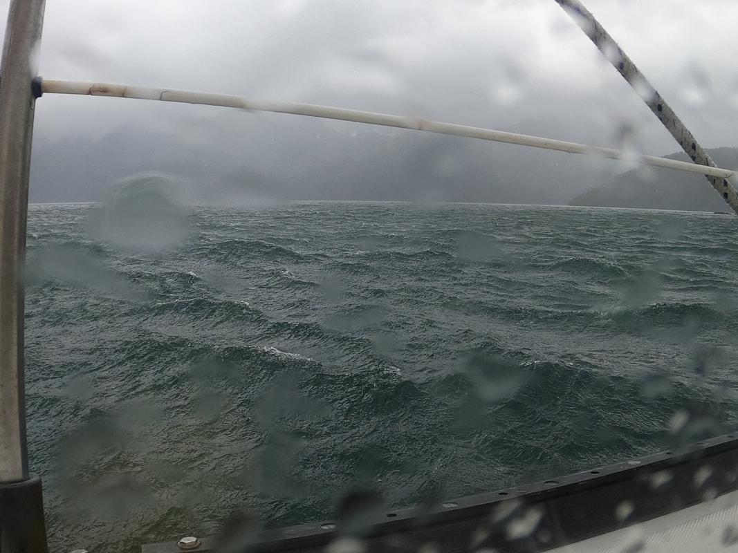
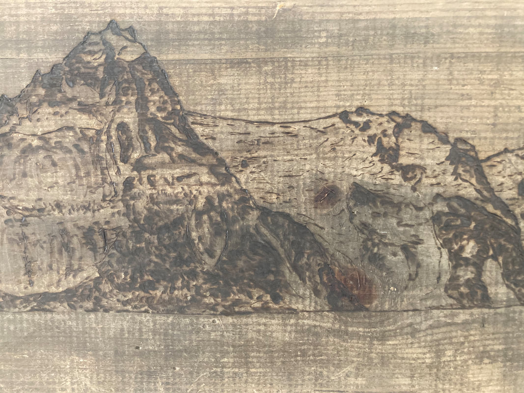
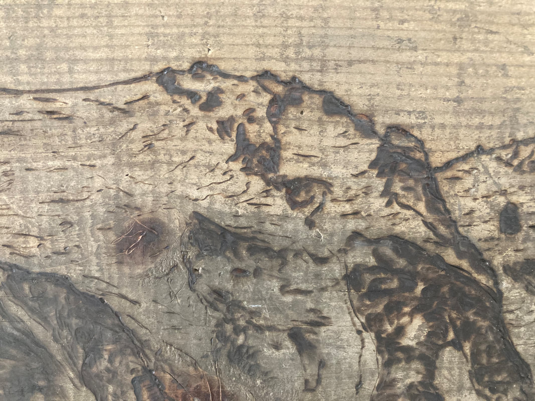
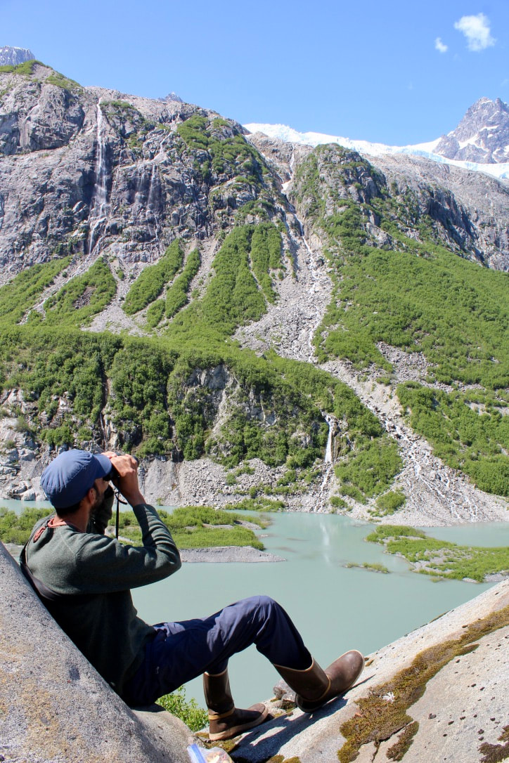
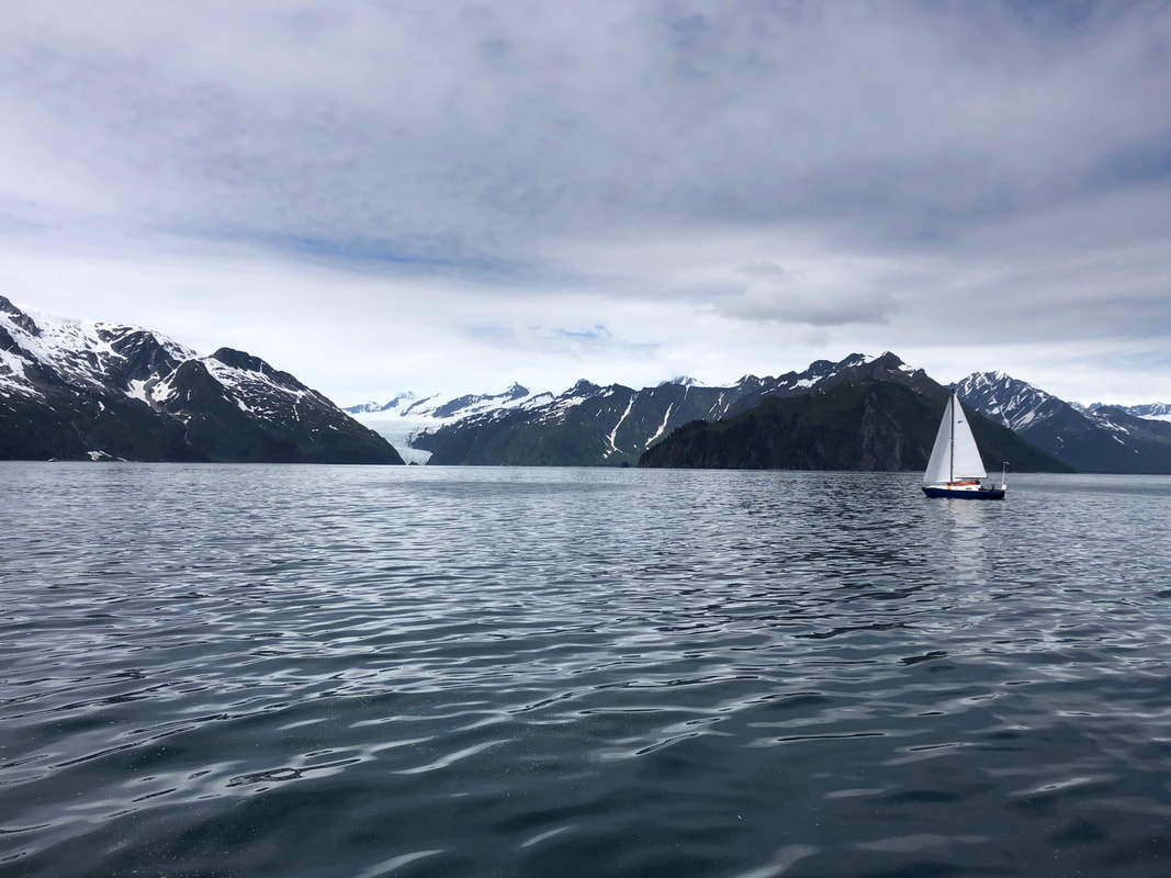
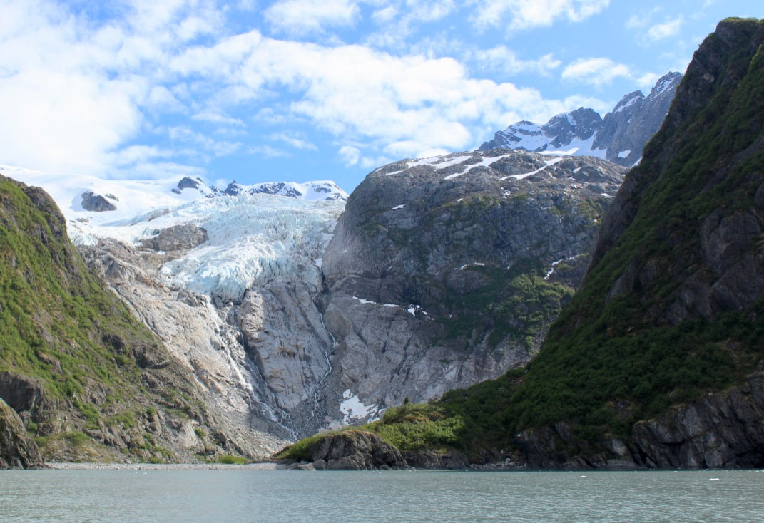
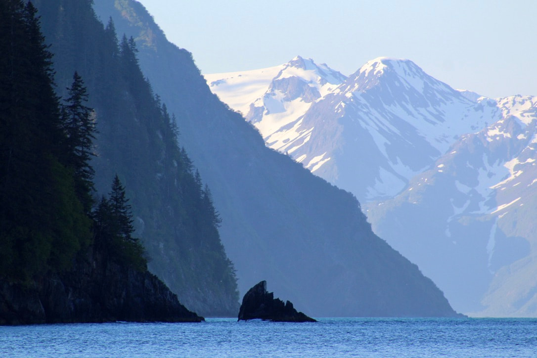
The wind filled in during the afternoon and we were able to sail ExN into the widest part of the Harding Gateway. It was a treat to be in this spot, rather than hugging the coastline, because from here we could see to the west the towering peaks and glaciers of the Harris Peninsula over the lower jagged ridgeline of the Aialik Peninsula. Ellsworth Glacier in Day Harbor was visible to the east, and Rugged Island and the familiar shorelines of Resurrection Bay to the north. The afternoon update of the forecast still had 17 foot seas for two days on the horizon. But now Wednesday is in the forecast, and the seas drop back down to 9 feet. Before we didn't know what was on the other side of this storm, but seeing further into the forecast makes us scratch our heads - things don't line up. Brent sent inReach messages to a few folks asking them to look into it, and our friend Charity looked online at the NOAA models and Windy models and didn't see anything that looked like it would throw that much swell. She called up the NOAA Anchorage office, surprising the forecaster who apparently didn't realize the number was listed on the internet, and asked them to check in on this forecast. We can't thank her enough! A few hours later, we heard the computerized voice of the marine weather forecast change from seventeen foot seas to seven foot seas. It was a typo, or a forecasting mistake, or something. We were shocked it wasn't caught over the last four forecast cycles, as hundreds of people listen to these marine forecasts daily to make decisions on how to operate safely on the water. Tour boat captains, water taxi drivers, kayak guides - many people live and work around the dynamic weather conditions of this coastline. This finding was both a relief and frustrating. We didn't have to worry about a massive storm, but we also spent a good deal of time, effort, and resources avoiding a system that didn't actually exist. Though if the original forecast had been accurate, or even close, our decision was a safe call and we were happy with that. Forecasts are incredibly useful, though not infallible, and we were fine with the decision we made with the information we had available. A push of over sixty miles today, phew. Unfortunately none of my photos from this morning captured the big swell along the outer coast. Now anchored in 90 feet of water in the back of Sunny Cove. Quick dinner of beans and rice with cheese and fresh limes. Brent and I laugh at how we're so close to Seward, yet we still feel two weeks away (his phone isn't working and I let my contract temporarily lapse). Cell service is all around us, but we're happily looking at clouds. 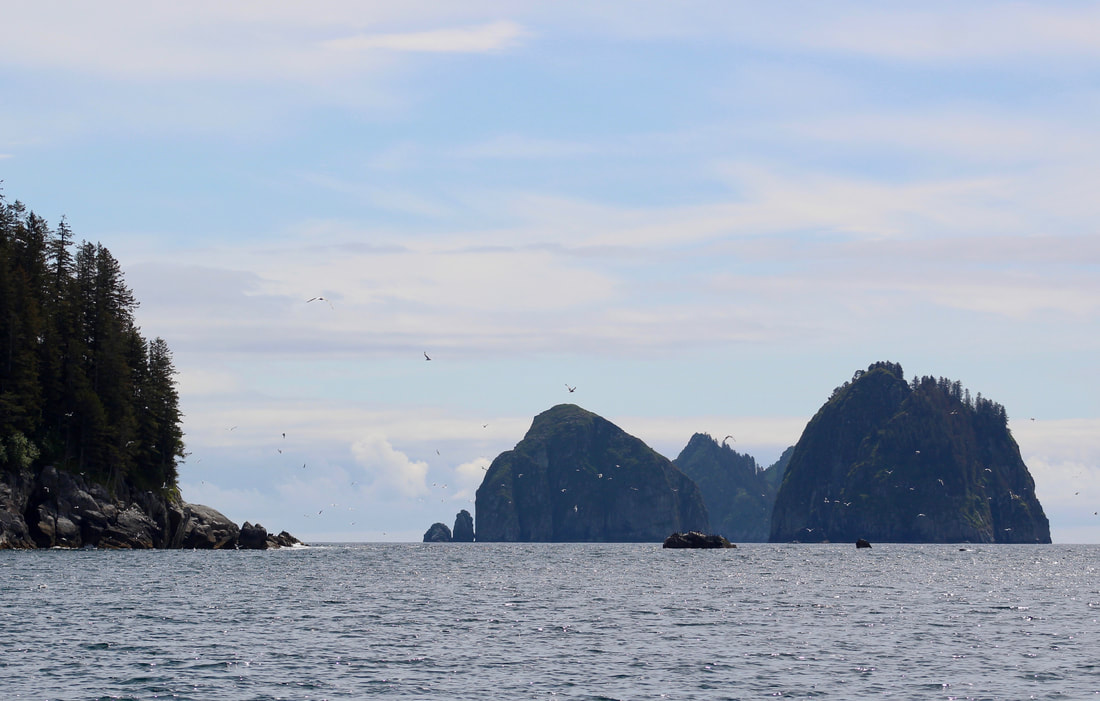 Even the stress of 17-foot seas didn't distract us from this beauty! Jumping out of our voyage narrative for a moment to share some of Brent's recent artwork - a woodburning of Northwestern Fjord. Brent found some beautiful salvaged wood and set up shop on our porch to create this piece. It was chilly working outside in 15 F winter weather, so regular warm-up breaks to stand back and look at the developing piece were an important part of the process. I hope you enjoy this woodburn as much as I do! These photos only capture a hint of the piece. Many thanks to Brent for sharing his artwork with all of us, and stay tuned for more! 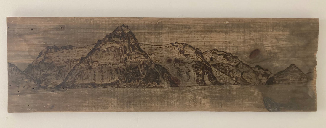 Northwestern Woodburning - West (Brent Pikolas)
 Ughh. And to think the photo doesn't do it justice... Excerpt from the log: 17 June 2020 Pilot Harbor, Nuka Bay (Day 2 of gale) Anchor watches through the night and all morning. Em from 11pm-2am, Brent 2am-5am, Em 5am-8am, Brent 8am-11am, Em 11am-2pm... Then we were both awake and very tired. Extremely windy with strong gusts (probably 40-50 kts) through the night. Stays humming and quivering, halyards slapping despite being secured, wind howling through the rigging, and waves slapping the hull. Around 11am the gusts became less intense but the wind generally more sustained. I loved listening to the patterns that emerged - how you could hear the wind gust whistling as it arrived before the halyards began to rattle, and how after a gust passed through there would be a heavy splatter of rain on deck as if the clouds carrying it departed with the wind but forgot to bring the rain along. The alarming sideways heeling when a gust hit our beam, the eventual tug of rode stretching to a well-set anchor, followed by the quick jerk of the bow straightening out back into the wind. During the 30 hours of this gale we read, played rummy, peered out the portholes, ate sporadically, and placed marks on our chat plotter when large gusts stretched out our anchor chain and rode (we had a full 170 degree arc over the course of the storm). We were relieved when the wind died down in the evening. Gales are exhausting! Especially with only two of us to keep an eye on everything. The quiet was lovely, though almost eerie, after tuning into to each and every sound on the boat and in the environment under those intense conditions. 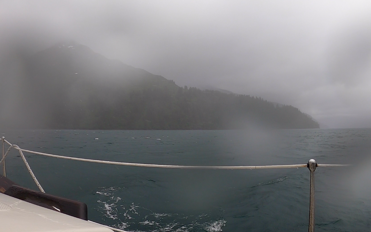 This cove provided a secure anchorage during the gale, though it was still windy!  Because of the mountainous topography deep in this fjord, we could not get any VHF radio signal. Luckily we were able to receive forecast updates via our InReach (Thanks again, dad!!) 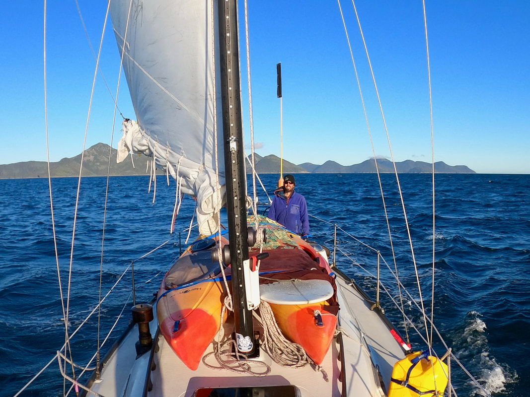 Enjoying lighter winds after a long blustery day beating to weather. The Pye Islands in the distance. 14 June 2020 Erratic Island (Northwestern Fjord) to Quartz Bay (West Arm Nuka Bay) via McArthur Pass 0900 - Haul back at Erratic Island 1015 - Northwestern Moraine 1930 - McArthur Pass 2300 - At anchor in Quartz Bay 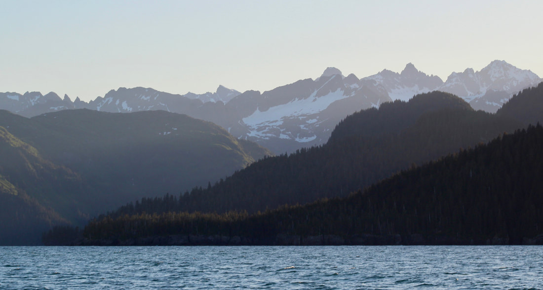 Stunning mountain ridgelines and the excitement of coastlines I have not yet experienced. Amazing start to the day with a tiny harbor seal pup on an iceberg drifting right past the boat while we were drinking coffee. Hauled back, netted some brash ice to top off our ice box (while we were still near tidewater glaciers), and crossed the moraine with the tide. Set sail and worked to windward for the next few, well, 9 hours. Nice light breeze at first, then steadily filling into a strong day breeze which was forecasted for SW 20 kts. Gusts to 30 kts as we sailed out along the outer coast. We encountered a similar pattern with the sea state - small, steep chop at first at the mouth of Harris Bay transitioning to much larger and steeper waves, 5-footers with a short period. Katabatic sailed fairly smoothly considering these conditions, but smoothly still includes a lot of launching and slamming around in the waves. One wave caught the furled genoa and filled it with seawater, so we dragged the sopping wet sail back into the cockpit by our feet to keep it secure and keep the foredeck clear. We enjoyed sun all day with the high pressure system, but also sailed upwind all day. And because of the angle of the wind relative to McCarty Peninsula we felt like we were treading water on one tack, but zooming along on the opposite tack! Fun to see this coastline up close. Some interesting strata, steep cliffs, keeper beaches with large round boulders, and some very weathered trees. Killer whales joined us for a few tacks, and one swam up right next to the boat. They are so large, and you really appreciate their immensity when they're swimming directly at you! The Pye Islands provided a bit of lee as we approached McArthur Pass around 1900. We motored through the pass with the current about two hours before the high tide. Even with a light headwind we were making about 5 kts (usually we go about 4 kts without a headwind, so the tide was definitely helping us)! Lots of seabirds feeding around the current rips, many stands of gnarled trees, and a few panels of a damaged daymarker (the only navigational aid for many miles) remaining after years of storms sweeping through this topographical funnel and tearing at the landscape. Saw a Pacific Loon on the west side of the pass with its distinct silver nape. A nice welcome to Nuka Bay! Unfortunately, the day breeze combined with the strong southwesterlies of the high pressure system were still ripping on the other side of the pass. The wind was compressing against the Pye Islands, steady at 30 kts and gusting between 35 and 40 kts. Steep seas, lots of spray. Our whole rig was humming. It was disheartening to be motor sailing and barely making way at only 1 to 2 kts. We began to ferry out into Nuka Bay to get away from the compression gusts along the coast, which eased the pressure on the rig and allowed us to keep pointing into the wind while sliding across the widest part of Nuka Bay. We cleared Harrington Point, exhaled, and enjoyed a quick dinner-in-a-cup of quinoa and spicy lentils. The wind was still strong but much steadier out in the middle of the bay, allowing us to slowly turn away from the wind and eventually sail downwind into the protection of the West Arm of Nuka. The day breeze died around 2200. Eventually it got so calm that we had to strike the sails and motor. What a wild day of changing conditions! But this is coastal sailing in Alaskan fjords for you. It draws on all your knowledge and experience and patience and grit. It's the most challenging place I've ever sailed, but dang - when you can work with the conditions the stunning landscapes and seascapes make everything worthwhile. We left our stress outside the Beautiful Islands at the entrance of Quartz Bay and smiled at the chart showing a deep, even, and muddy anchorage. Set the hook just after 2300 in 100 feet, decompressed for a minute in the darkening cabin with the glow of a Luci light (haven't been awake at this time for awhile!), then slipped into a deep sleep. Relieved to be here after 58 nautical miles today! 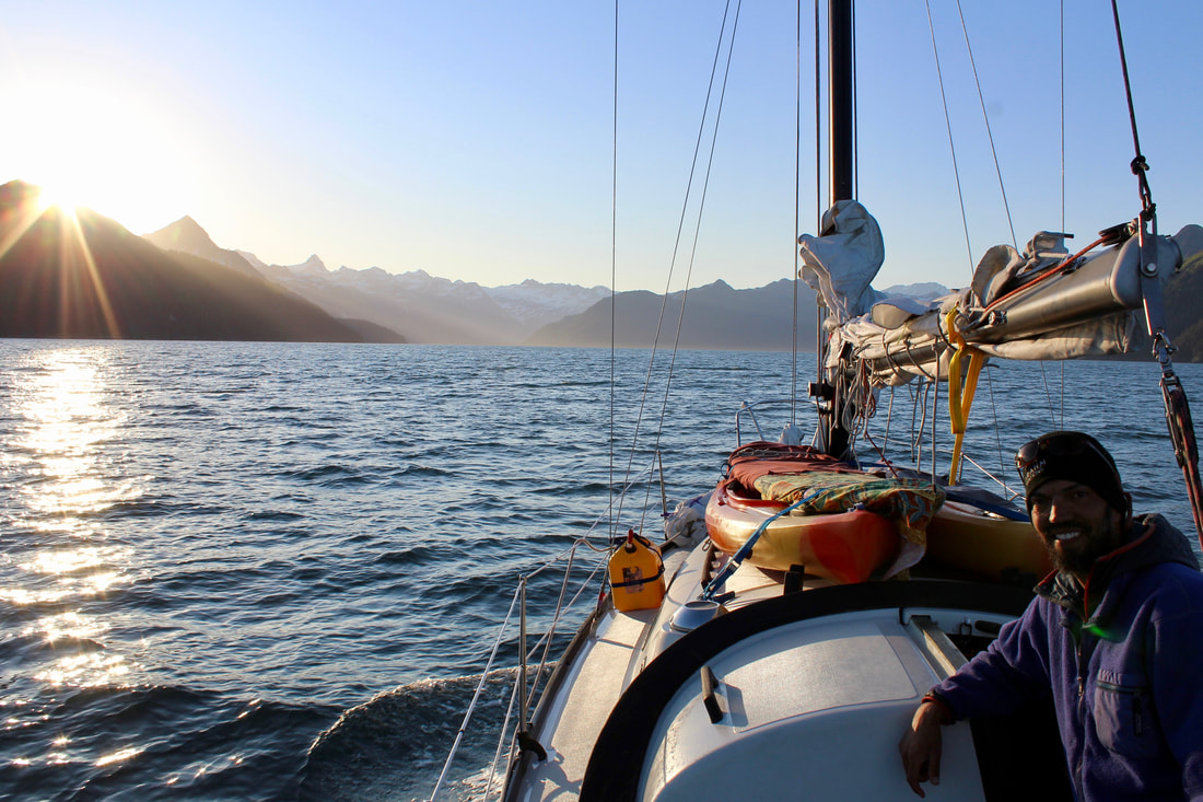 Hello, Nuka Bay! 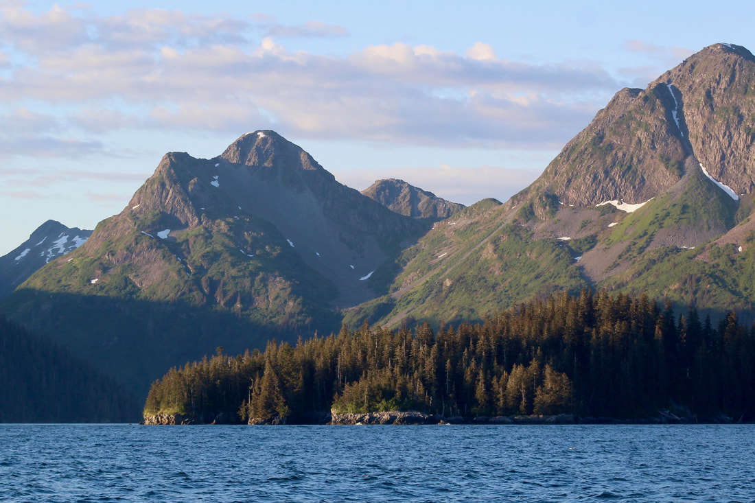 Eyeing paddling destinations for future days as we make our way up the bay. 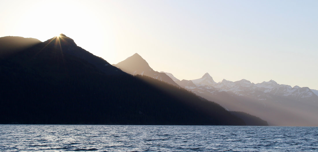 Loving the slow sunsets of mid-summer in the fjords. 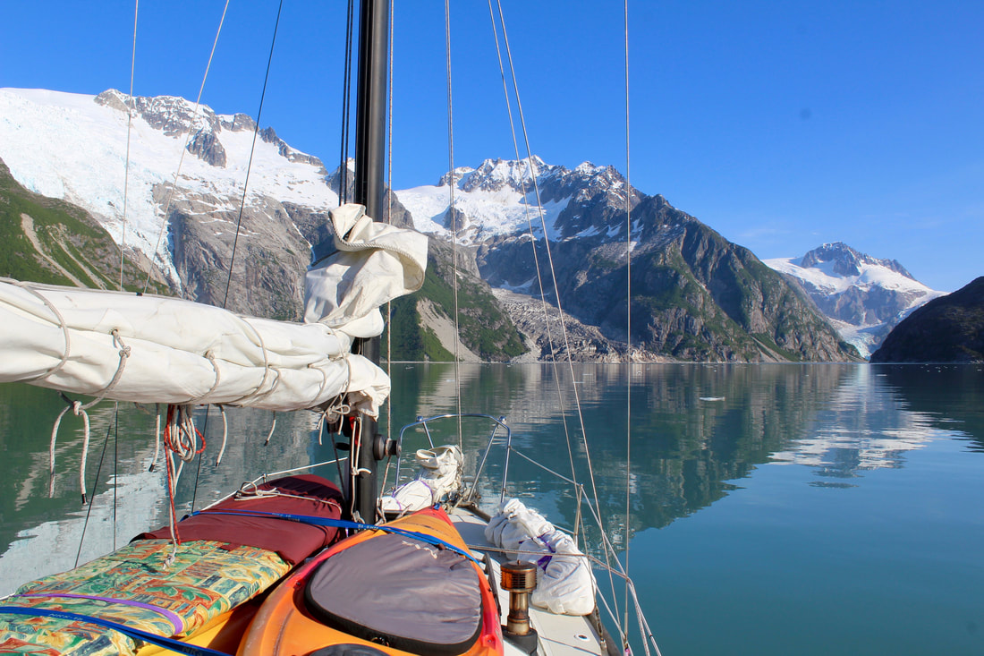 Home, Northwestern edition. 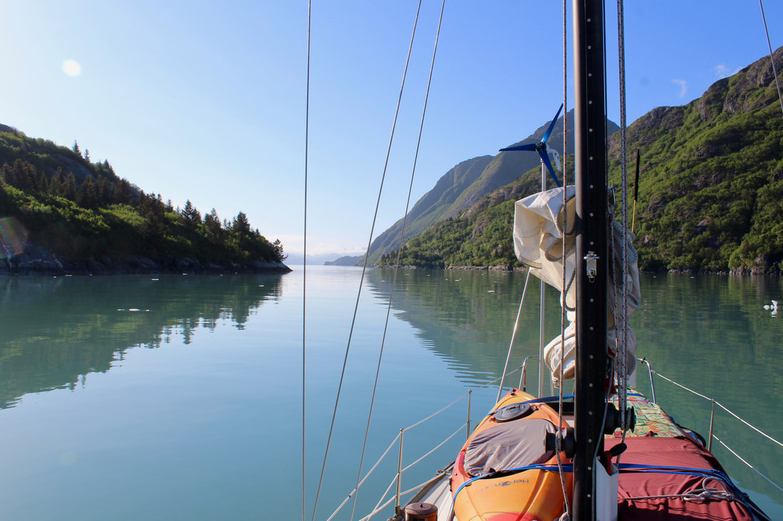 Home, Northwestern edition. We spent several days anchored in Northwestern. There was a strong high pressure system sitting in the Gulf of Alaska that provided a handful of uncharacteristically sunny days. Our location deep in the fjord sheltered us from the 20 - 30 knot southwest winds along the outer coast. We rose each morning to the sounds of oystercatchers trilling and glaciers calving. 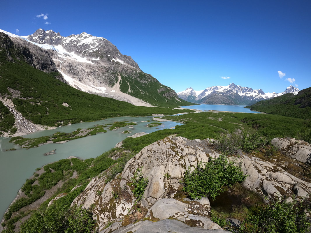 Enjoying some land-based adventuring in the upper fjord.
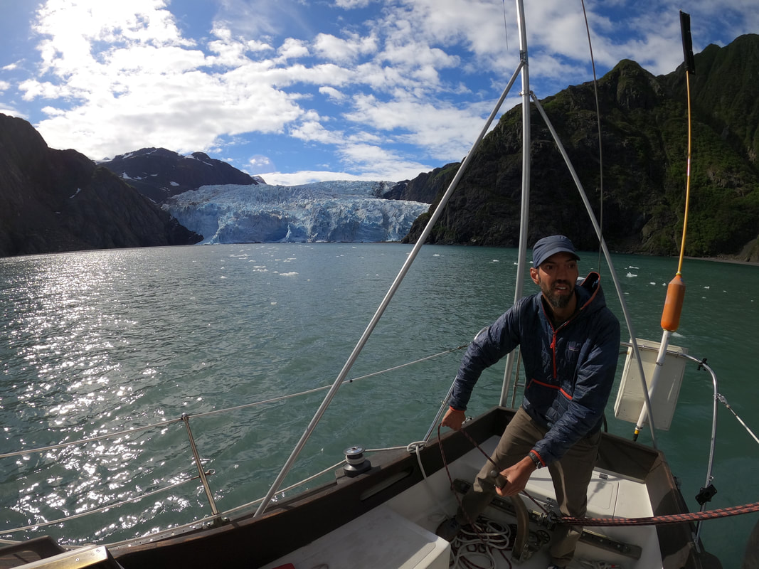
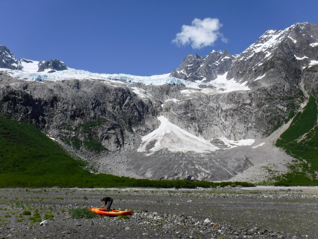
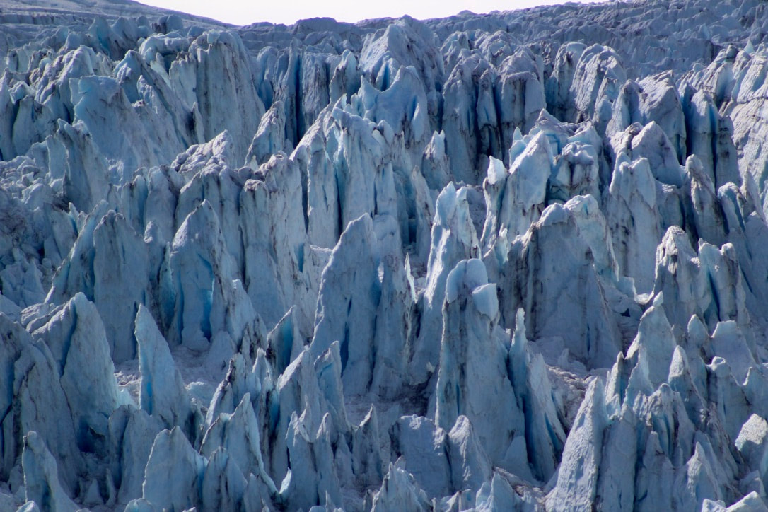
 Southwestern Glacier transporting silt from the mountains to the sea. 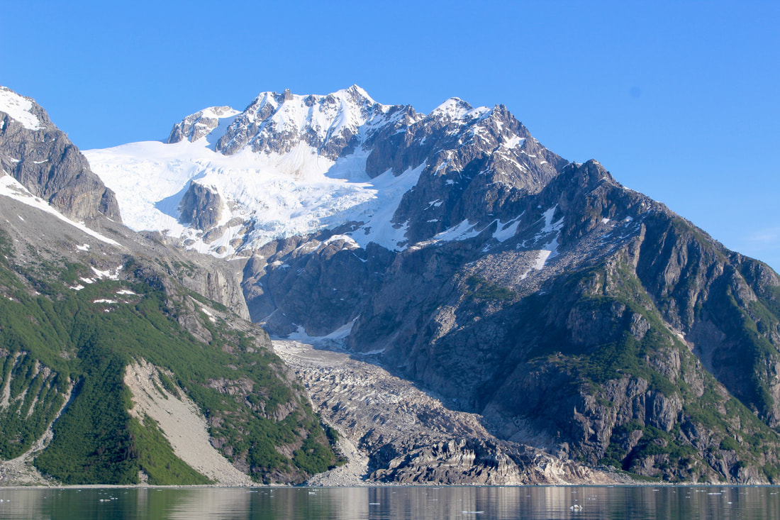 The banded layers of Ogive Glacier near the water were created from seasonal changes in ice/rock fall from the upper section of the glacier. We also topped up our fresh water supplies from a spring (more of a seep, really) spotted from our anchorage. Brent made several runs via kayak with our blue five-gallon jug. The tank was topped off by adding 12 gallons; we've adapted well to being more conservative with water now that we're off the dock and away from an easy source. Friends on a water-taxi dropping off kayakers brought us a small jerry can of diesel, just in case. We topped up - adding about two gallons of fuel (what we had used over about nine hours of motoring). Filling up this small amount was a stark contrast to what we'd grown used to working on power vessels around here, which can easily burn between 150-200 gallons of fuel in a day for a round trip to Northwestern Glacier. We covered this distance in about a week, and sailed much of the distance.  Water delivery! We enjoyed an evening on the shore of Erratic Island. I loved watching the beams of light dancing around the peaks and seeing Katabatic from a new perspective. Here's a photo taken during our time-lapse adventures (full video in the previous log entry).  Katabatic at anchor in evening light. Our final morning in Northwestern was very special. We were enjoying our coffee on deck when a piece of brash ice floated right past Katabatic - with a harbor seal pup on it! I put down my mug, ducked below to grab my camera, and emerged quietly to take a few photos. We watched breathlessly as the ice slid along just a few feet from the hull and the seal pup dozed and occasionally glanced around between naps. We could see the steam rising from its damp fur - warm from its body heat and drying off in the bright sun. Normally we would stay far away from pups on ice to not disturb them, but in this case all we could do was sit quietly and take it all in as the ice brought the seal to us. What a wonderful encounter!  A(dorable) harbor seal pup! 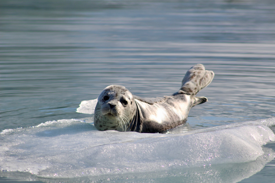 Keeping its flippers high and dry helps this pup stay warm. Less insulating blubber in the flippers leads to more rapid heat loss in the water. 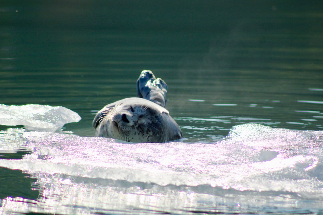 Can you see the steam rising from this cozy seal pup? 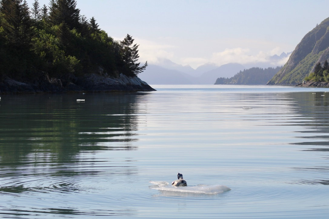 Seal pup drifting away with the tide. Time for us to go, too! This two-minute timelapse documents two hours in Northwestern Fjord as the sun dips slowly. Watch SV Katabatic bob on anchor and beams of light move around some of the tallest peaks visible from the water in the Kenai Fjords. 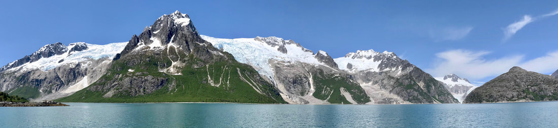 Northwestern Fjord! (Photo: Jessica H.) 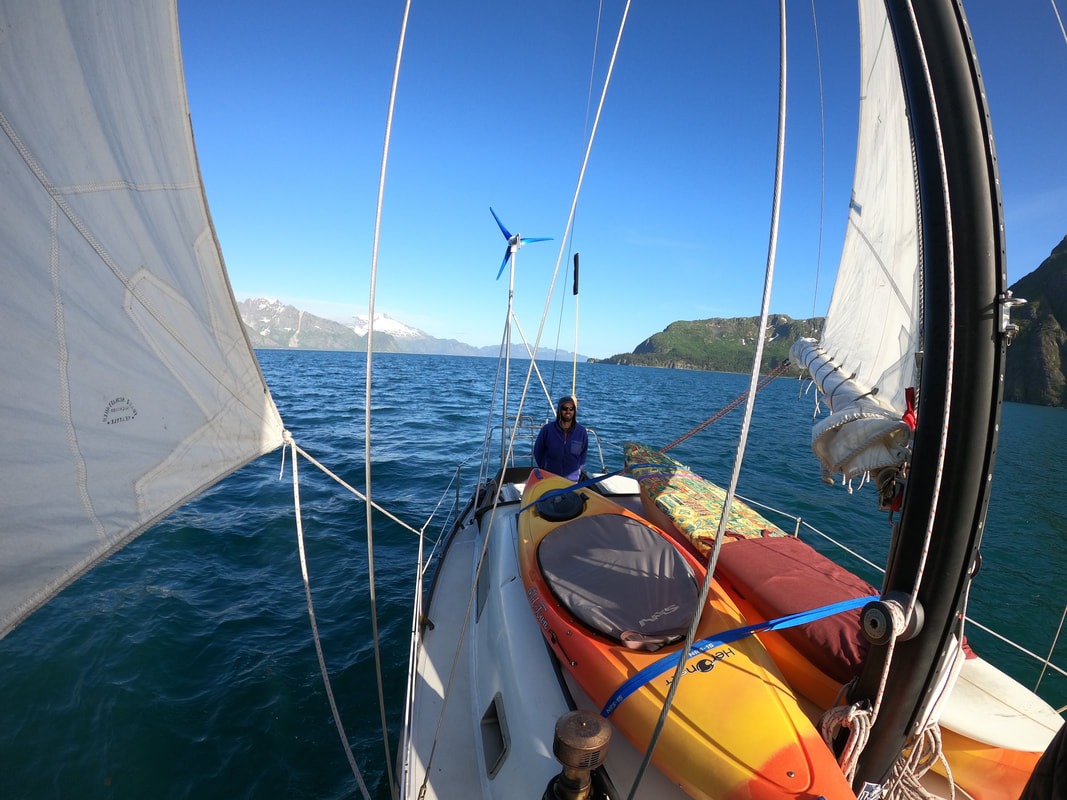 Sailing wing-and-wing in a light breeze feels wonderful after tacking into strong winds and chop for most of the day. Our original plan was to sail from McMullen to Paguna, but with shifting conditions we decided to sail up into Northwestern Fjord instead. This was one of many instances when we were thrilled to not have to follow a specific route or timetable, and a good reminder of why vessels are "bound for" places and not "going to" them - the destination could very well change! Having the flexibility to adapt our plans and make the most of the weather and the wind defined our approach to passage planning throughout the summer. We would closely monitor the progression of the fjords' dynamic conditions and keep an open mind to consider the many possible routes. 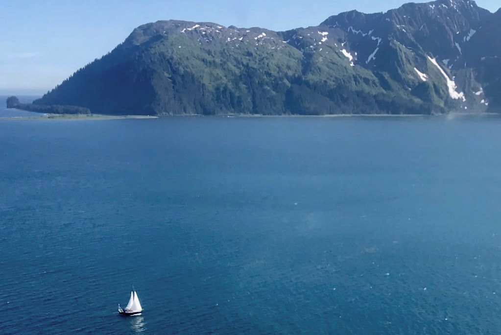 Katabatic sailing into Northwestern Fjord. (Photo: Jessica H.) Log Excerpt: 11 June 2020 1100 - Depart McMullen 1530 - Aligo Point 1815 - Northwestern Moraine 2015 - At anchor off Erratic Island in 82 feet Lovely morning in McMullen with frequent trilling calls of Oystercatchers. Took about half an hour to haul back in this deep spot, did the clockwise spiral exit of the cove. Zoomed across to the relative lee of Paradise Cove because it was much windier out in the bay than it looked from the mouth of McMullen. Reduced sail to working jib and double-reefed main, then tacked our way up the west side of the bay and up Dora Passage. Really dark blue water today, clear skies and windy! Steady 20 knots, nothing like the variable 10 knots forecasted. A humpback was cruising in the Dora with us, each exhale being thrown with the sea spray as soon as it was expelled from the blowhole. Long period and fairly large swell coming in from the SE, and a fair amount of wind waves and chop coming from the SSW. Katabatic was riding the swell and chop wonderfully when we were on a port tack headed SW, but it was bouncy when on a starboard tack with the confused and conflicting seas. The wind was building as we approached the southern tip of Granite Island, where we decided to tuck into the passage and check out Northwestern Fjord for a few days instead of beating to weather to get to Paguna along the outer coast. A great call. Steady wind off the quarter with still a bit of swell, so we struck the main and calmly cruised up towards the moraine under just the jib. Reset the reefed main then sailed through the moraine’s passage at 1815, just an hour before high tide and perfect timing to let the slowing tide gently help us through. We saw a yellow plane soon after – Paul and Jess! They flew close, dipped a wing, looped around us then flew off toward Crater Bay. So amazing to be out here, and then to have friends fly by! 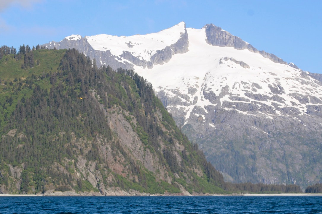 Friends! Can you spot the yellow plane? 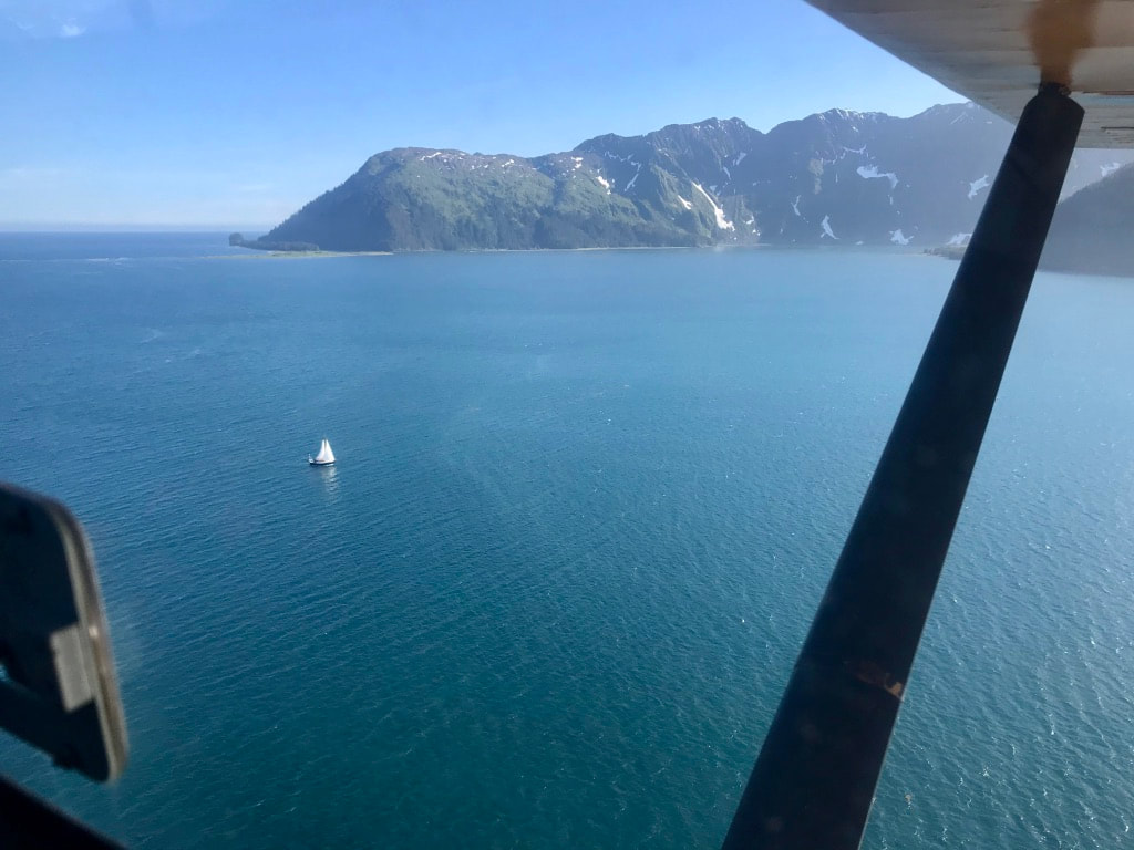 Katabatic viewed from the plane. In the upper left is the moraine where Northwestern Glacier terminated in 1894. (Photo: Jessica H.) 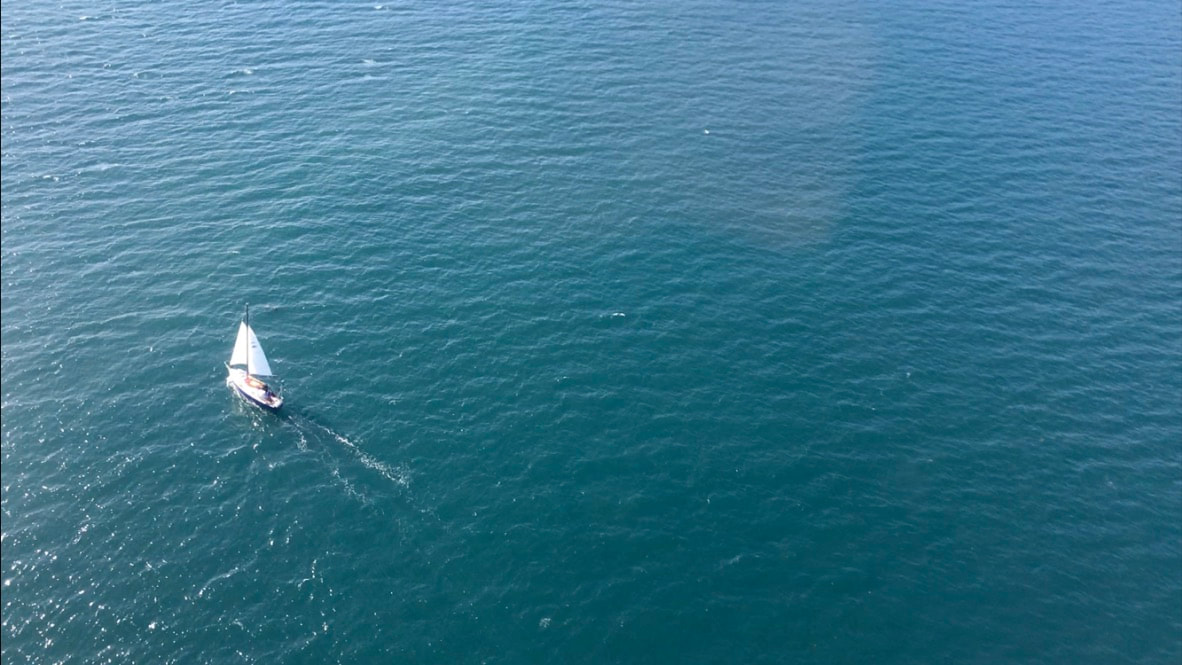 Amazing conditions - light winds on the quarter as we sail deeper into the fjord. (Photo: Jessica H.) Soft golden light as we sailed wing and wing up the fjord and right to our anchorage near Erratic Island. Stunning views of Northwestern, Ogive, Anchor, and many other glaciers. Easily one of the most scenic anchorages in Alaska. While we were sailing Brent made a veggie roast of potatoes, carrots, onions, garlic, jalapeño, thyme, and rosemary in the cast iron and had it in the oven, with the aromas wafting up on deck. We turned off the oven just before anchoring, and sat down for a hot and delicious meal as soon as the hook was set. Incredible day. 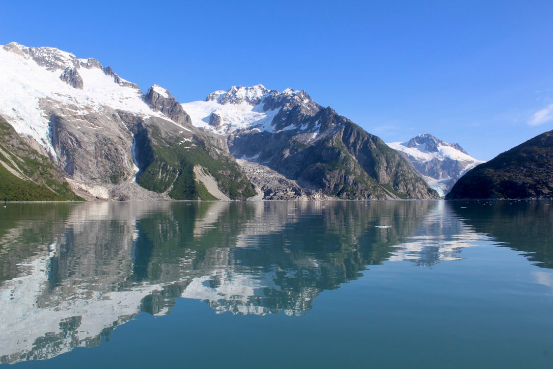 From our anchorage we could see (and hear) Anchor, Ogive, and Northwestern Glaciers. 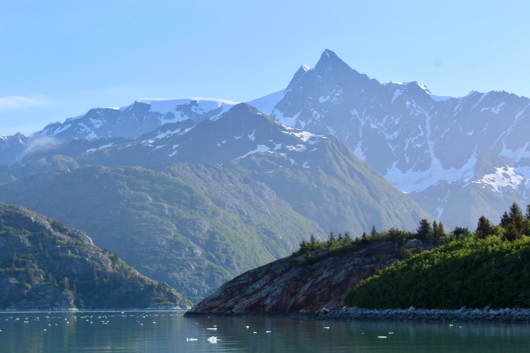 So beautiful! Gazing around at anchor. 10 June 2020: Paradise --> Holgate --> McMullen 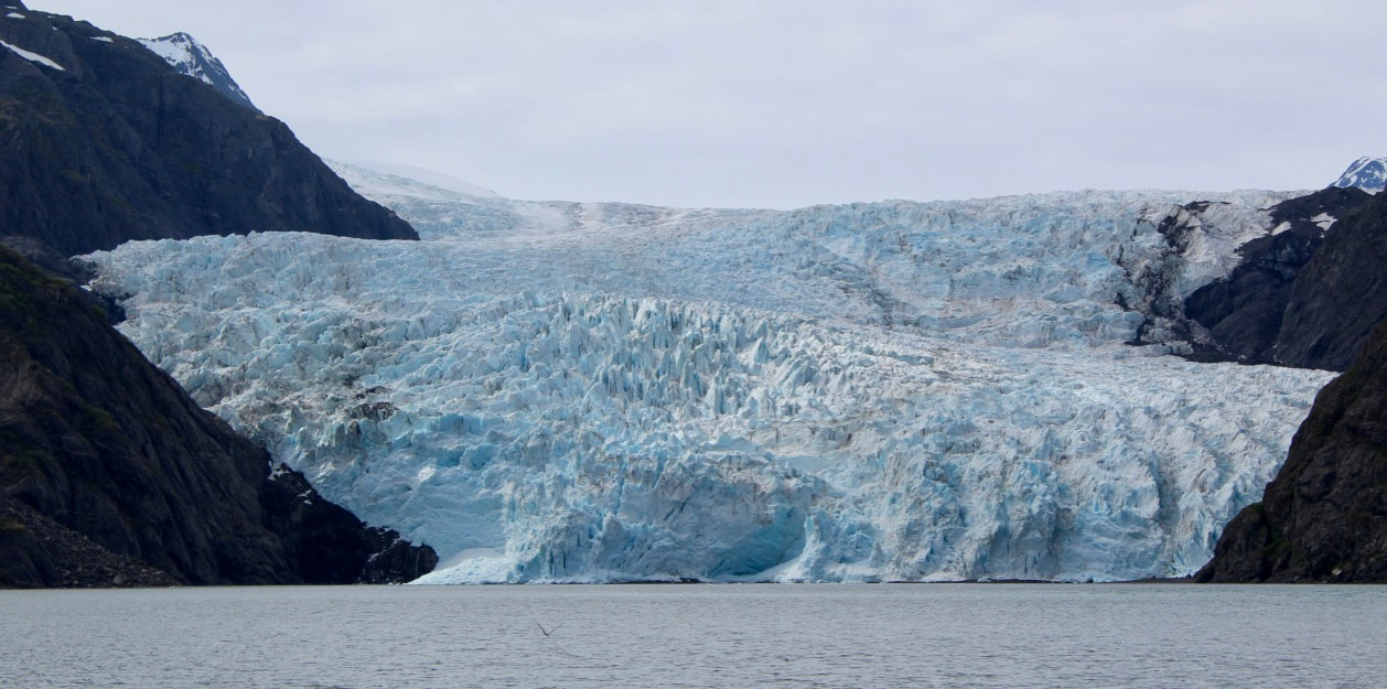 Holgate Glacier is a tidewater glacier, which means ice flows all the way to the ocean from the Harding Icefield.
 Sailing up Holgate Arm in ideal conditions! 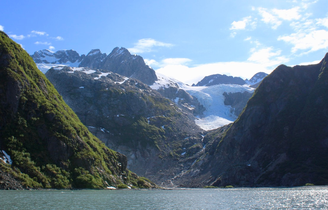
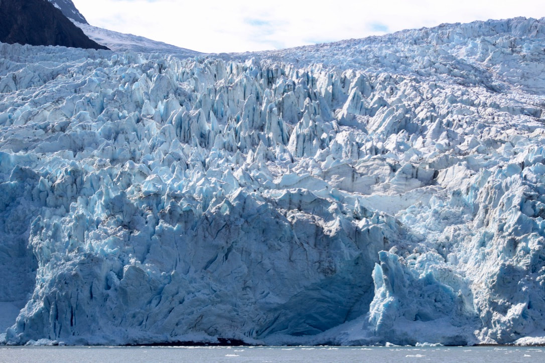
 Brent sailing to the perfect size brash ice near the face of Holgate. I netted small chunks to restock our ice box. "Sailing around the face of Holgate Glacier was definitely a life sailing highlight for us. It was so quiet, serene, yet we were alert and very aware of the ice. Brent reflected how having been to Holgate so many times, being there under sail felt like the first time he was seeing everything. A fresh perspective on a familiar place. For him, this afternoon was a culmination, or a new level, of driving boats through icy water, reading the wind and water, and having the boat move exactly the way you intended it to. I loved the flow we got into as a team on the sheets and the tiller, streaming through the silt-tinted green-grey waters and making graceful turns around chunks of ice sparkling in the evening sun."
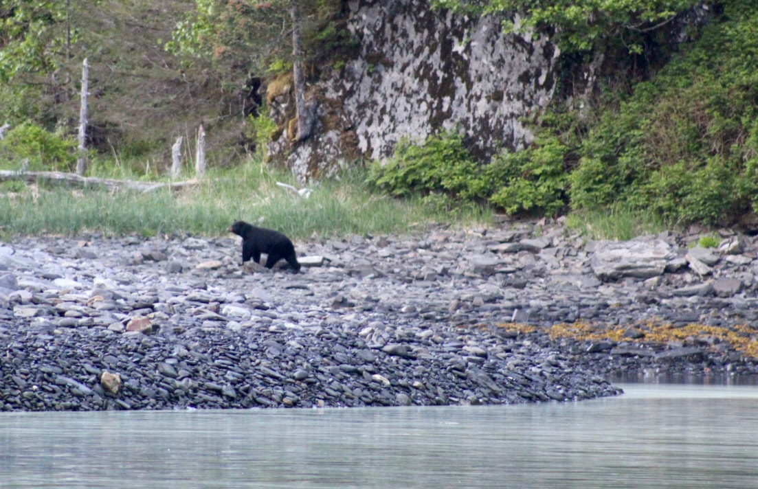
We had to tear ourselves away from the glacier in the late evening to sail south to McMullen Cove for the night. We anchored in our usual spot in about 130 feet of water, protected by a shoal with great views of steep mountains, small waves, and a beach combing black bear.  Our view at anchor in McMullen Cove.
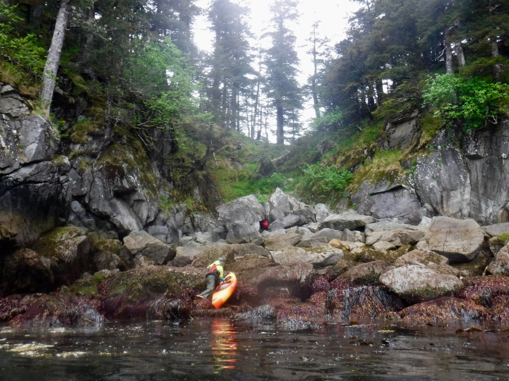
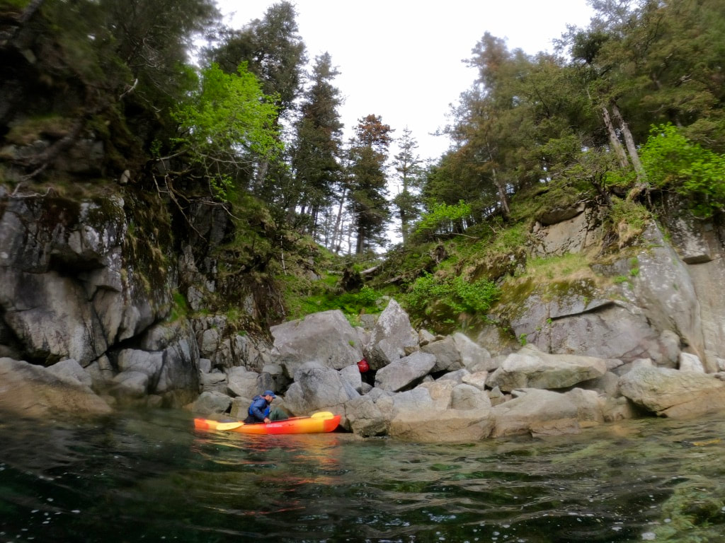
 After years of anchoring here, this cove feels homey and never fails to inspire! 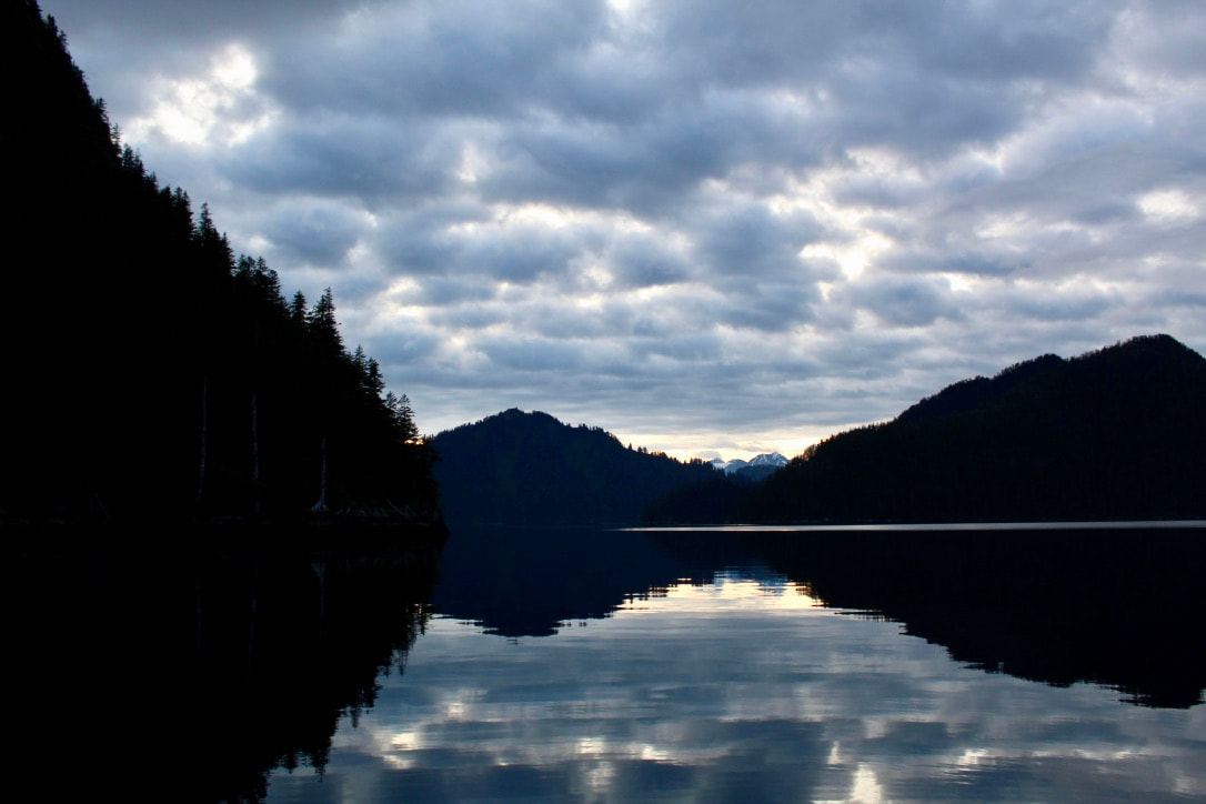 A calm evening at anchor in Paradise Cove. 8 June 2020Very calm last night. Coffee and egg/cheese/avocado burritos before off exploring in kayaks around 1230. Scouted the obvious pass into Cliff Bay (too steep to carry kayaks down the south side) and a more hidden route nearby with a gentle mossy path. Decided to paddle instead of carrying the boats over – the flood tide at full force and a southerly breeze made it a bit more difficult, but it was a lovely paddle. The steep granite cliffs exposed to storm waves from the south had deep vertical cracks that made booming and gurgling noises with the gentle swell. Brent got some great recordings of this stretch of coastline’s soundscape from the kayak. We saw a few harbor seals, a Steller Sea Lion, a humpback, and a number of kittiwakes, horned puffins, and cormorants. A light drizzle started about halfway through our counter-clockwise adventure around this peninsula, so when we made it back to the pass we portaged the kayaks over quickly so I could get back to the sailboat and put the solar panel away. We were content paddling in the rain, but the panel is not waterproof!
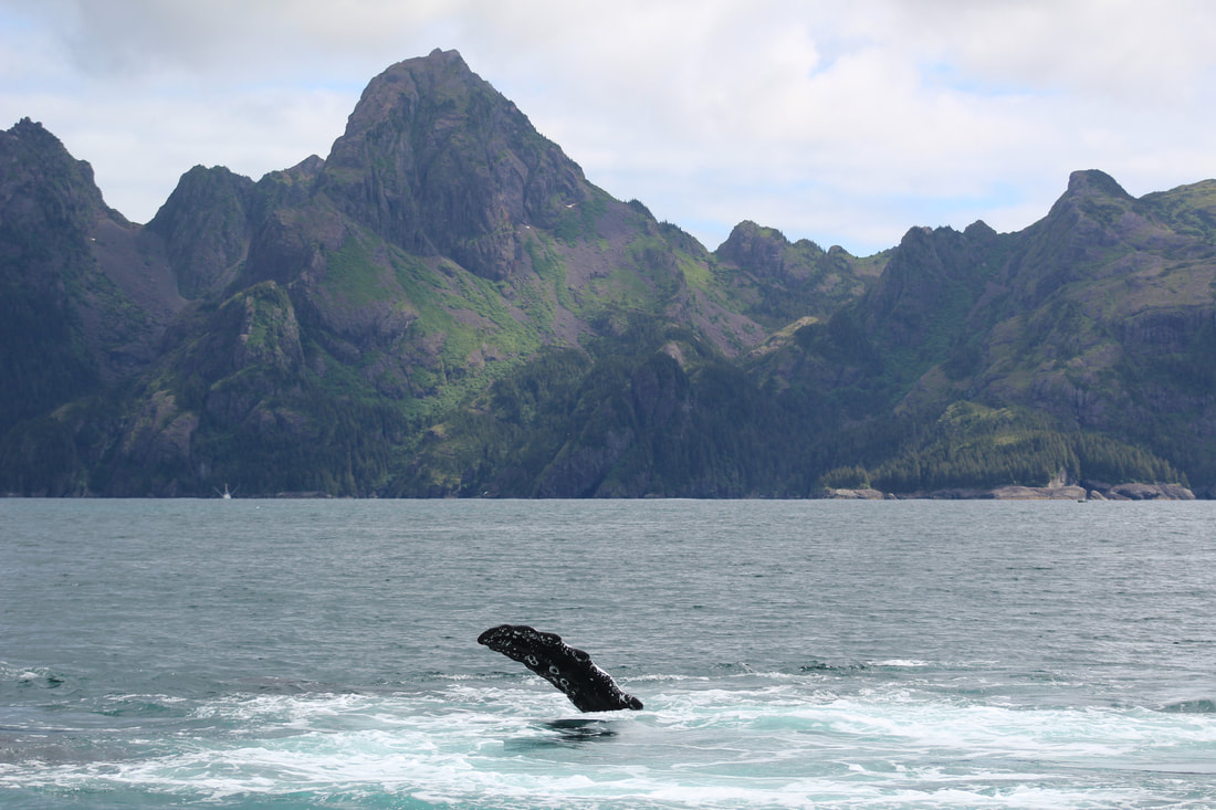
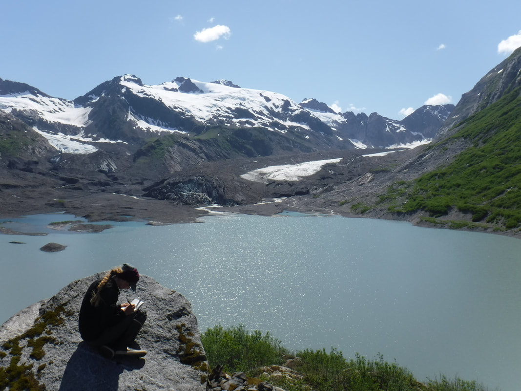
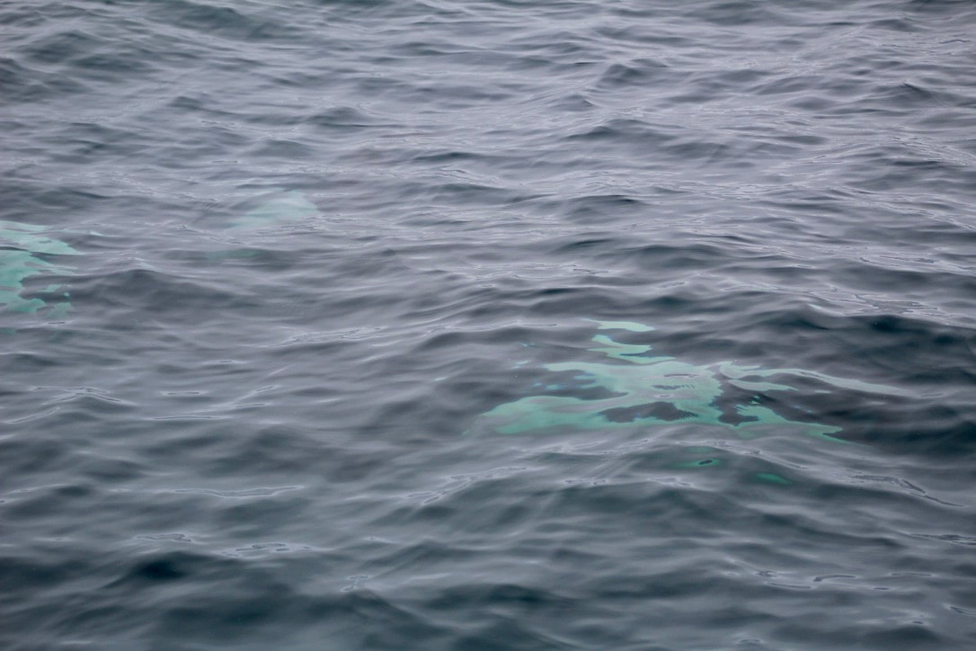
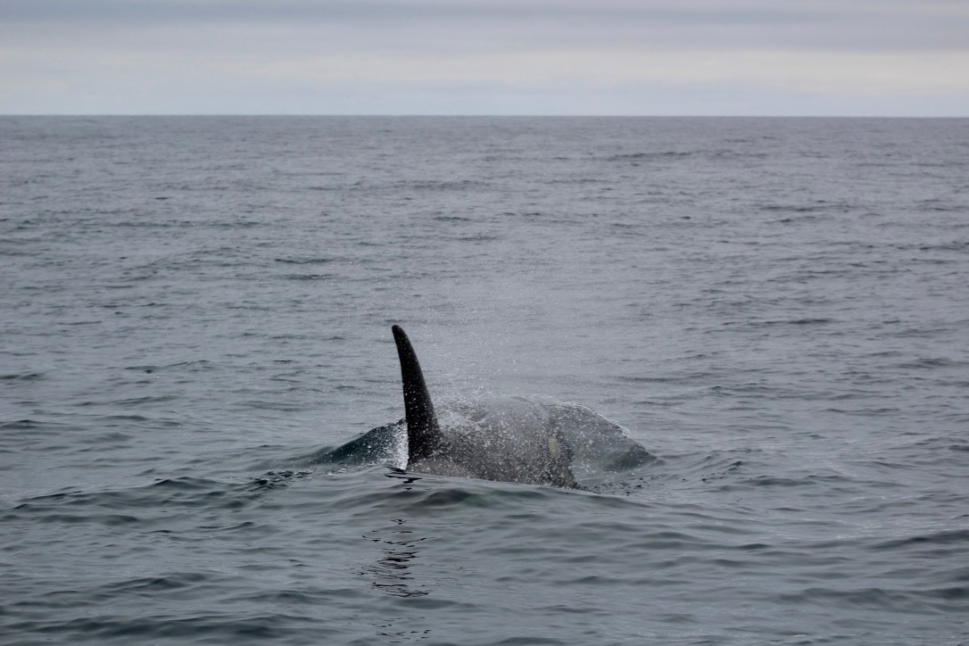
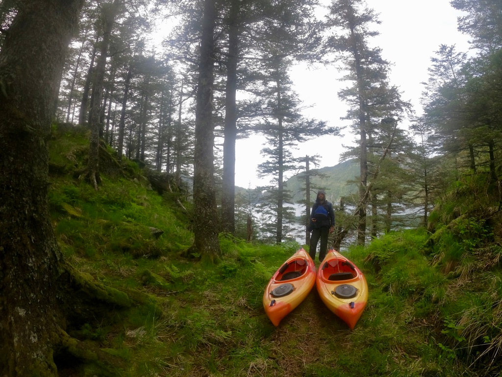 Enjoying the mossy terrain of the saddle. We decided to save paddling to the Cape for another day in the near future and instead went for a short cool-down paddle across Paradise Cove to the low pass over to Agnes Cove. This is a major bottleneck for all (land-based) animal traffic on the outer Aialik Peninsula. As soon as we left the boats and clambered up into the mossy forest clearing we could tell this was a very popular spot for bears. Salmon scales in scat from years past, claw marks in the mud, roots dug up, a well-trodden trail – all the usual signs. We didn’t walk up to the saddle but enjoyed peeking into the very comfortable bear life here in Aialik. Back to the boat for a hot mug of Bengal spice tea, a “Week in Review” dinner (leftovers) with chili oil, a podcast, and the cozy heat of the stove. Early to bed. Calm. 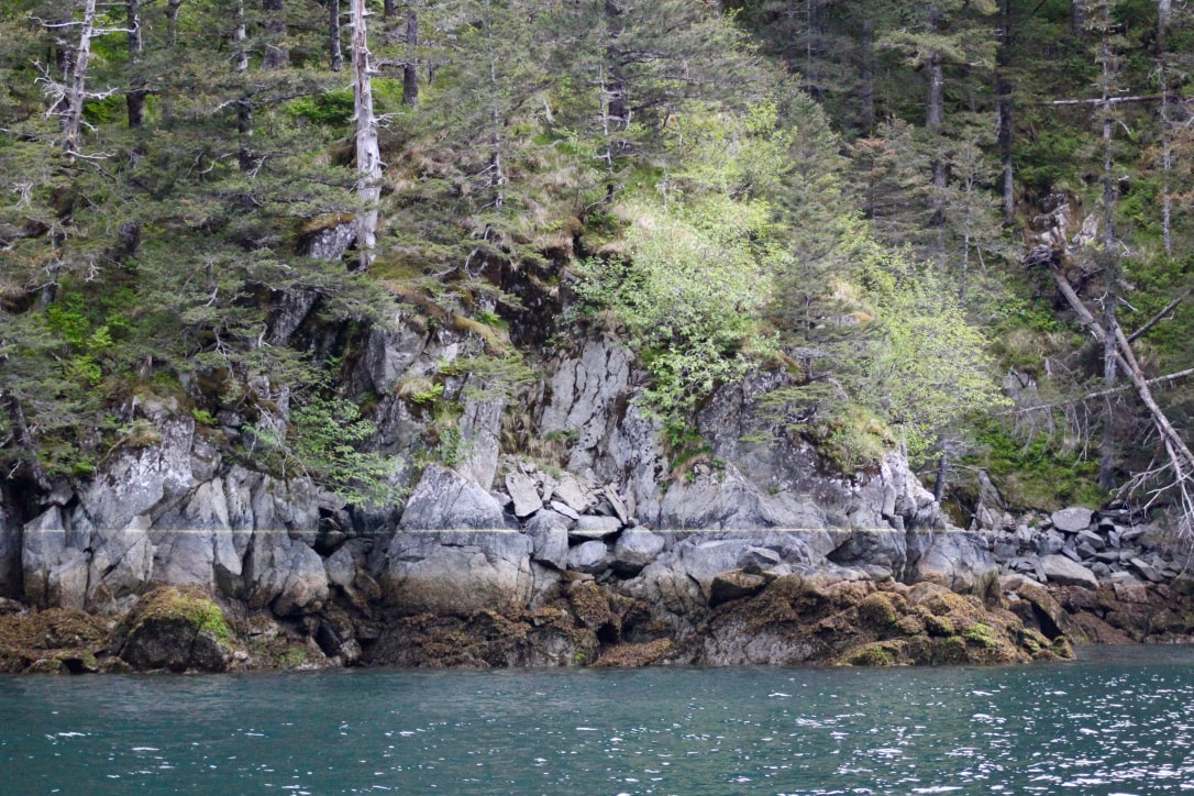 Pollen from Sitka Spruce trees that has blown into the ocean forms a 'bathtub' ring at the high tide line. 9 June 2020Another lovely, calm night. Morning coffee and breakfast with thrushes singing, then gear together for a full day exploring via kayak. We carries the boats up the steep and mossy pass, unfortunately smack in the middle of a very low (-2 ft) tide. Overcast skies with some low clouds, intermittent drizzle, just a gentle breath of wind – a great paddling day. Fun to see so many sea stars and anemones and deeper seaweeds exposed as we paddled out of Cliff Bay. The tide was against us, but this was no surprise and we were very motivated by the lack of any significant swell in the outer bay. Forecast for Cape Cleare to Gore Point today is variable wind 10 knots, seas 4 feet. Amazing. 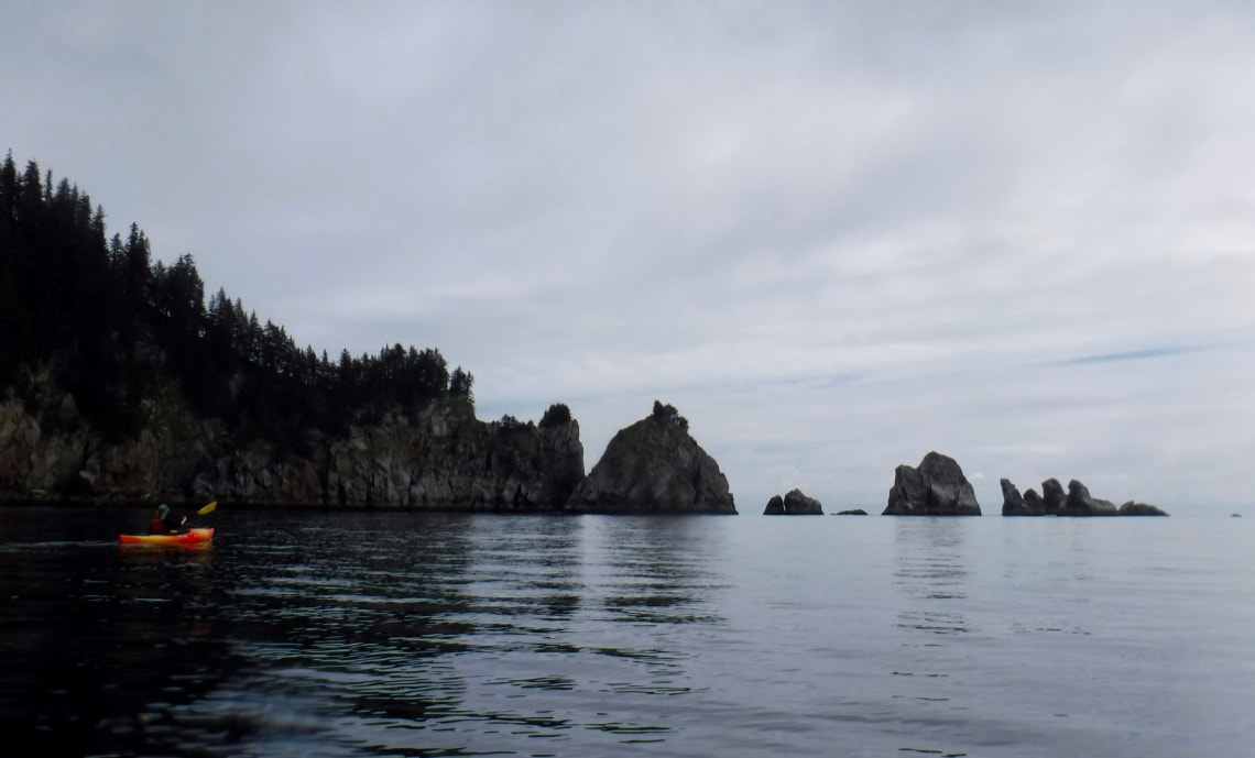 Emily paddles south towards Cape Aialik in calm conditions. Dall’s porpoise with steeply angled dives swam near to us on our paddle out, misty heart-shaped humpback spouts in the distance, and puffins flying by that narrowly avoided collisions with us by steering away at the last second. We arrived at the Cape around 1330, shouted “Northbound Chicken Pass!” before paddling through the rocky spires, then admired a perfectly balanced ‘window’ rock formation and the Cape proper. One small Hughes craft motoring past was quite surprised to see us out there in little kayaks and checked in to make sure we were okay. 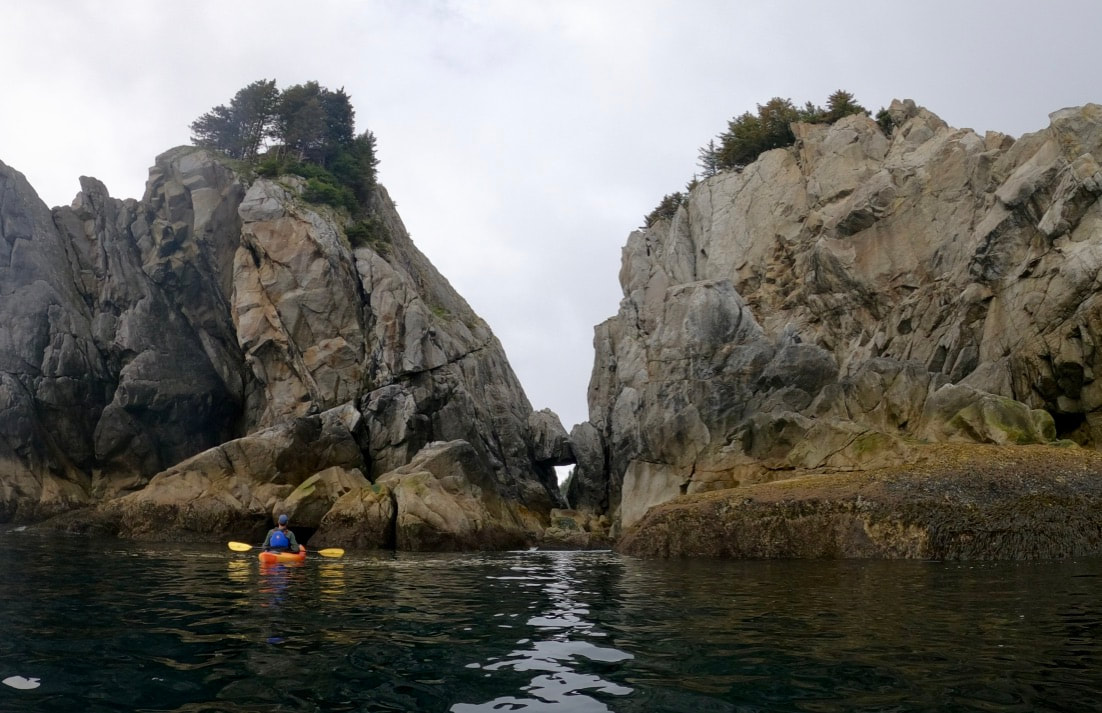 Brent checks out rock formations from the water. 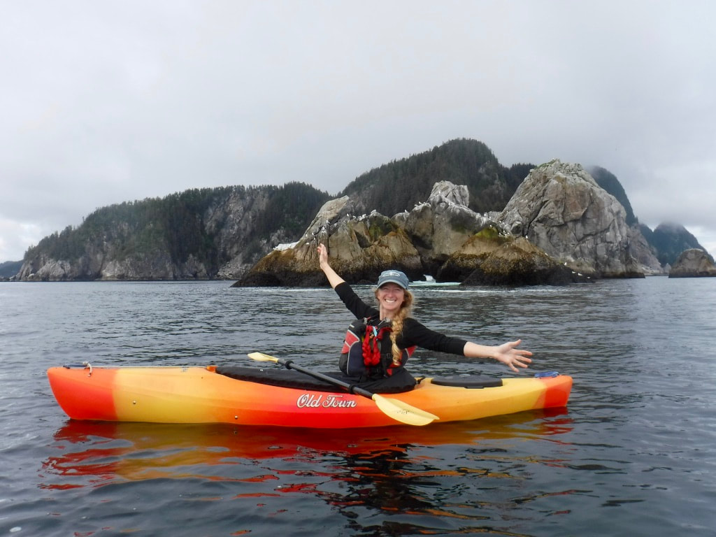 Thrilled to be at the cape! 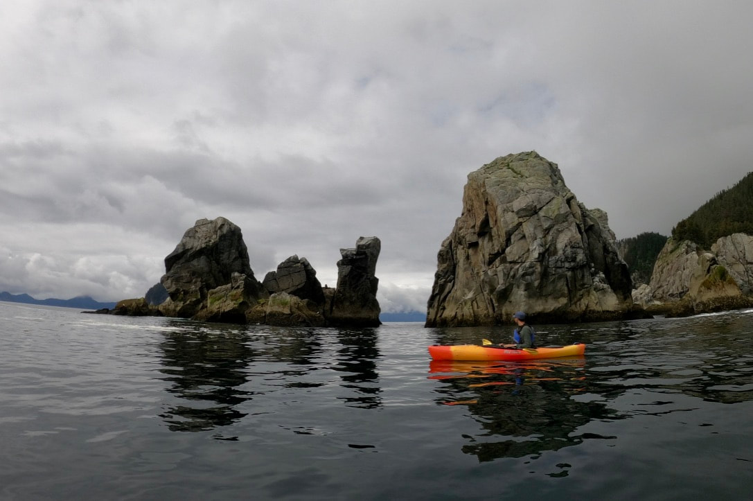 Calm conditions at Cape Aialik. The Gulf of Alaska with no wind and gentle swell was incredible – a place I’ve wanted to kayak for years. But it gets better. Orcas headed south from No Name towards the Cape! El Dorado was one of the bulls we saw, and his dorsal fin seemed even more towering from just a foot above the water. To hear the orcas breathing so clearly, and cutting through the water so quickly – wow. I wish I had the words to describe this highlight experience. We paddled back towards the coast, took a break for lunch deep in Chat Cove (not many places to easily climb onshore), and portaged from Cliff Bay back to Paradise. Chips and salsa to start, quinoa with veggies and Italian sausage for dinner, and hot cocoa for dessert. Tired and happy. 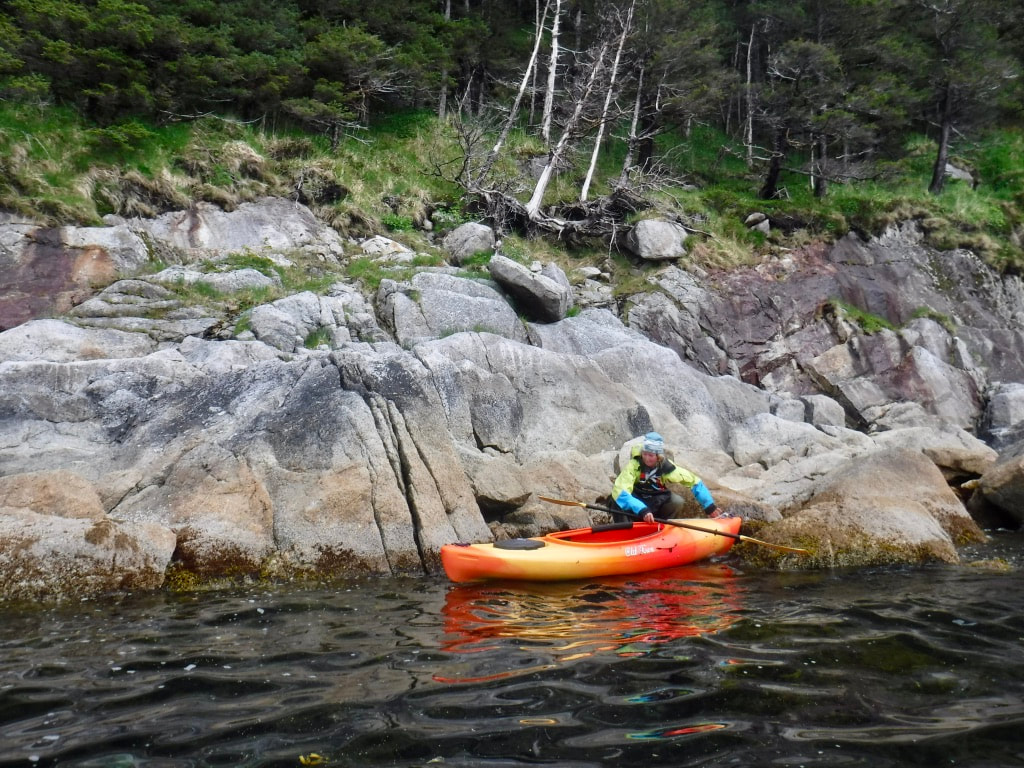 The steep granite coastline near the Cape has only a handful of comfortable kayak landings. One incredible thing about spring and early summer along the Alaska coast is the abundance of wildlife. With so many hours of sunlight - and days rapidly lengthening through the June solstice – the conditions for plankton to grow are just right. This spring bloom feeds many different kinds of organisms, all eating at a variety of trophic levels (or different parts of the food web). Salmon congregating in coves along the eastern Aialik Peninsula in late May and early June attract special marine mammals whom I’m always thrilled to see: Killer Whales. Also known as Orcas, Killer Whales are an iconic species and an important part of marine ecosystems here in Alaska. They are part of the Cetacean group that contains all whales, dolphins, and porpoises, and are the largest member of the Delphinidae family of ocean dolphins. There are several distinct ecotypes of Killer Whales that feed on different types of food – resident whales that eat fish, transient whales that eat marine mammals, and offshore whales that eat sharks. These specialized populations are genetically distinct and have not interbred for thousands of years. In addition to varying diets, these types of Killer Whale also have different lifestyles, behaviors, and personalities. Killer Whales have strong family bonds and remain in matrilineal groups their entire life - often 60-90 years. These family groups called pods will travel together, cooperatively hunt, and raise young calves. Individuals will mate with other Killer Whales outside of their family group, then return to their birth pod. 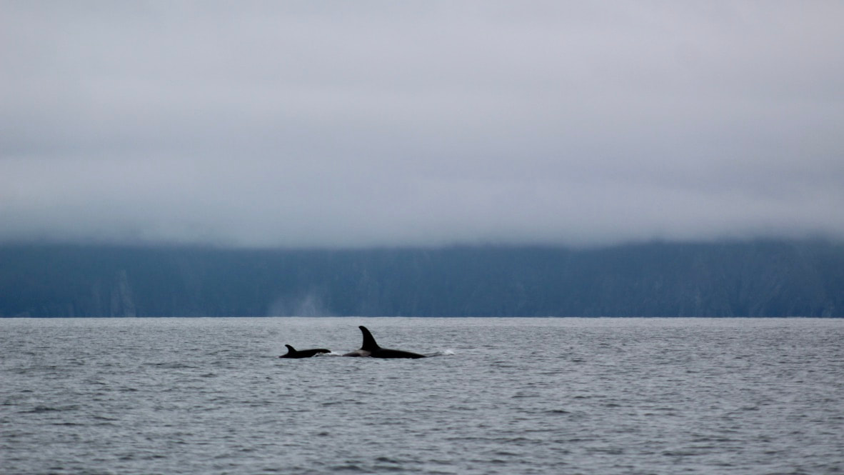 There is a lot that we still don’t know about Killer Whales, but the impressive amount of information we do know is thanks to the dedication of marine mammal researchers and scientists all over the world. Decades of close study and photo identification efforts have allowed researchers to map out family trees of many pods. Photos of the left side of a whale’s prominent dorsal fin and saddle patch can be compared to other photos in a database to identify individual whales based on markings, scars, and other distinct patterns. Hydrophones collecting underwater acoustic data have allowed researchers to recognize clicks, whistles, and calls - types of vocalizations used by the whales to communicate, and to even recognize the accents of specific pods and individuals. There is so much more fascinating information about Killer Whales, so check out these great resources to learn more: * Killer Whales of Southern Alaska, by Craig Matkin, Graeme Ellis, Eva Saulitis, Lance Barrett-Lennard, and Dena Matkin * Beyond Words, by Carl Safina * Into Great Silence, by Eva Saulitis *If you are looking to purchase a book, consider buying it from an independent bookstore – like Innisfree Bookshop in New Hampshire or Title Wave Books in Alaska! One of my favorite things about encountering Killer Whales along the coast is the reverence and awe they bring over groups of human observers. While deckhanding and kayak guiding I would see it often – a group of people quieted by the sense that they were observing something special. And because the geographic range of an individual pod is so large, any sighting of these marine mammals is exciting because their home is spread over hundreds of miles of ocean. It was no surprise that those same feelings of awe and excitement brought us to silent giddiness within the first few days of our voyage. Unlike most other encounters with Killer Whales we have had, this time we were on Katabatic and gliding quietly along under sail. With no engines running, the soundscape consisted of gurgling water against the hull and the short, bursting breaths of the Killer Whales surfacing all around us. Incredible! While we were maneuvering to keep our sails full and the boat headed generally where we wanted to go, several Killer Whales swam closer to us and paralleled our course. They swam close enough that you could see their white eye patches glowing light blue through the water, and even their undersides when they turned sideways, presumably to check out the hull of the boat and the two humans leaning over the rail to get a better view. What an experience! At one point Brent was on the tiller and I was up on the bowsprit with my camera and we were only communicating with facial expressions and hand gestures: “Is this really happening?!” 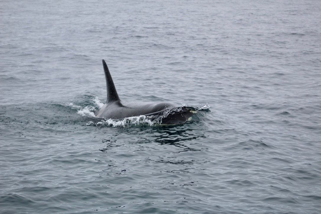
We tacked back and forth a few times to maximize our time with this pod, most of whom were hunting near a cove where researchers have observed them feasting on salmon this time of year. Eventually we sailed beyond their zone of interest, and our new friends returned to the other members of their pod. We watched their triangular dorsal fins emerging and disappearing at the surface until they were too far away to distinguish. A few days later, we had a weather window to paddle along the coast of the Aialik Peninsula to Cape Aialik. In any kind of sea state or wind this would be ambitious for our little 9-foot kayaks, but we had a rare glass-calm day in the Gulf of Alaska and went for it. Not only was paddling around the spires and cliffs of the Cape magical, but soon after we arrived a pod of Killer Whales swam through the area. Floating in our kayaks, we heard the same bursts of breath and marveled at the height of the male whales’ dorsal fins. Reaching heights of up to six feet, the dorsal fins looked towering when observed from our kayaks, barely above the ocean’s surface. 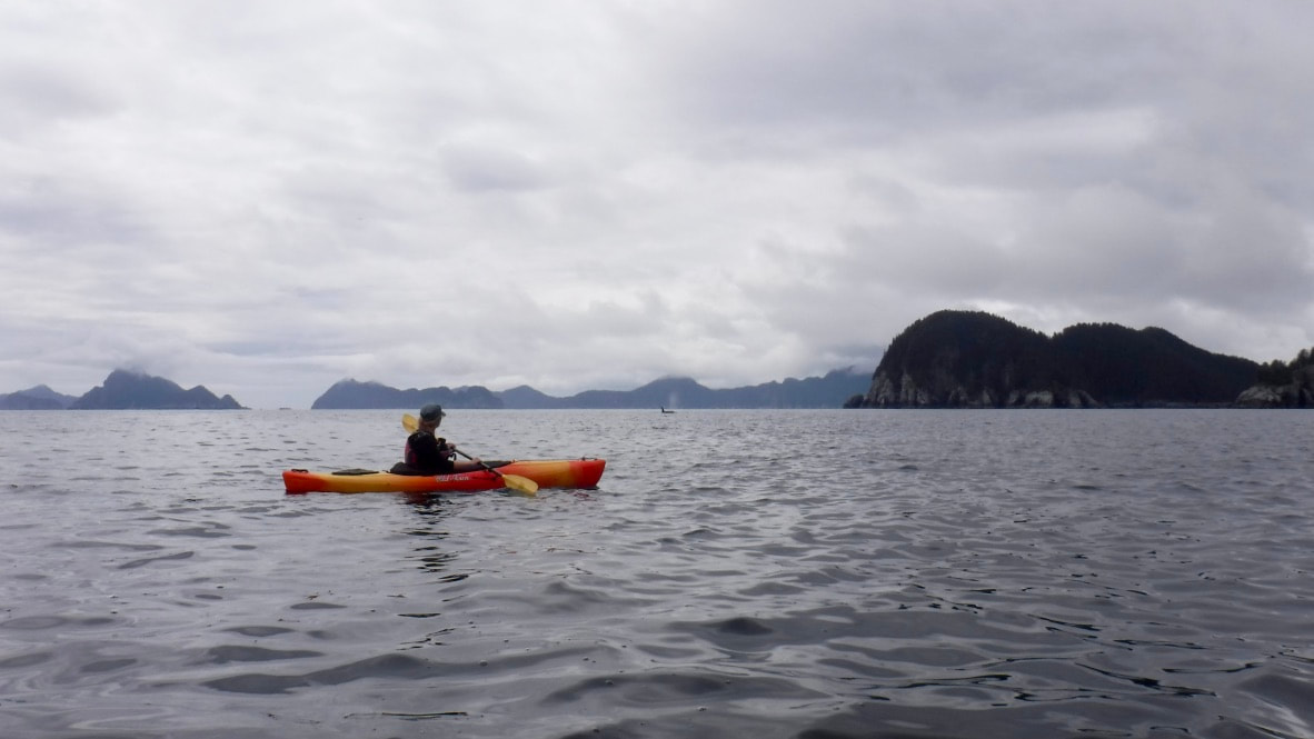 Emily paddling with Killer Whales at Cape Aialik (Photo: Brent Pikolas) The Natoa, a research vessel working with the Gulf Coast Oceanic Society, was nearby – photographing the pod and documenting behavior in their ongoing efforts to learn more about and promote the conservation of Alaska’s Killer Whales. We chatted on the marine radio with one of the researchers about the pod and individuals present, then wished them well as the Orcas turned offshore and the Natoa followed. 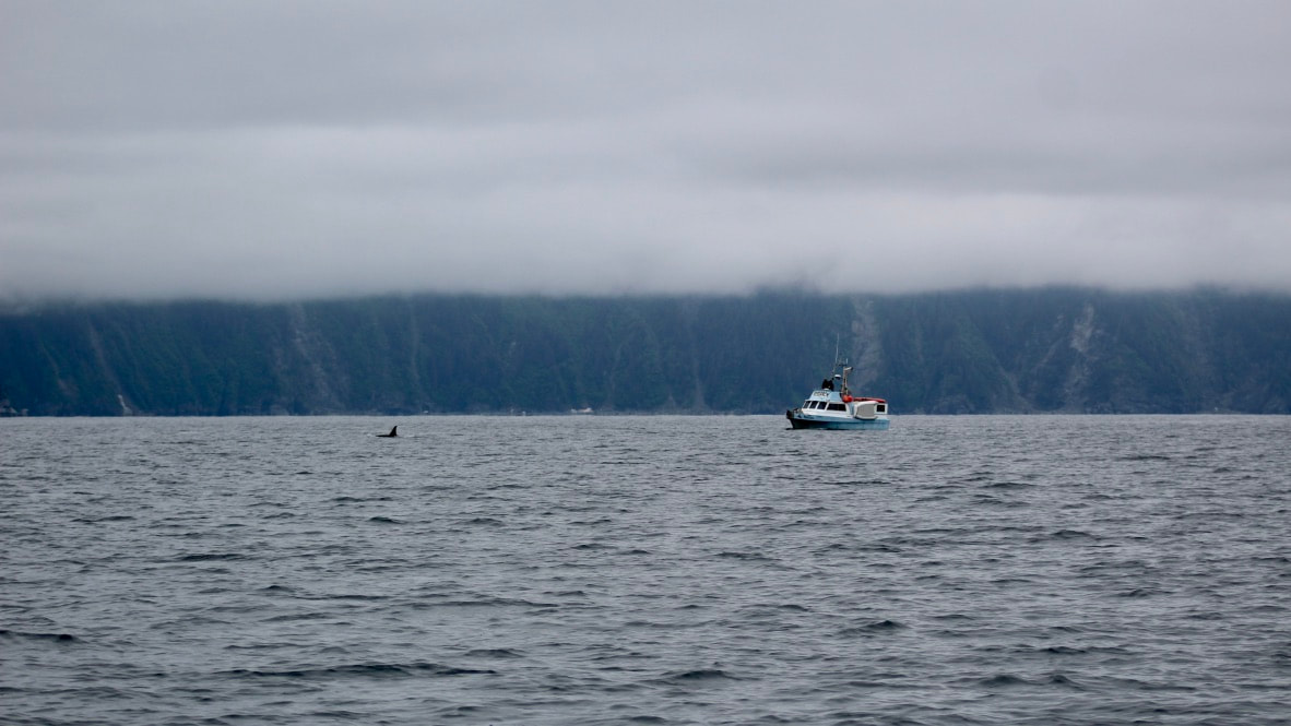 R/V Natoa It was a surreal experience to encounter this iconic species, with such complex communication and culture, at a fascinating location, often inaccessible to kayaks due to ocean swell and wind. Kayaking back along the coast to our protected anchorage was a blur. We paddled rhythmically in a silence weighted with reverence and awe.
Excerpts from the Elsaesser Fellowship ApplicationWhy the Kenai Fjords? Since I first arrived on Alaska’s Kenai Peninsula in April 2015, I knew it was a special place. I feel privileged to have spent the past five summers exploring the fjords through my work as a sea kayak guide and a deckhand based out of the town of Seward. I have had the opportunity to learn the many faces of the fjords, to grow familiar with particular weather patterns, to sense the subtle changes in light throughout the year, and to eventually feel the summer slip into a cool maritime fall. I have learned to identify seabirds at a glimpse by the way they flap their wings, and know which shelves to look for humpback and fin whales, how high on the hillside to look for mountain goats at a particular time of year, and where killer whales assemble to feast on the salmon that keep Alaska’s metabolic time. I have also been able to witness changes in the landscape since my first summer in the fjords, mostly in the recession of tidewater glaciers. I want to keep exploring further along the coastline, to places that summer work responsibilities and little time off have kept merely a dream. I aspire to learn more about this region, and really come to know it, while I still can sail and paddle in the presence of glaciers that carved these very fjords.
Why sailing? The plans for a purposeful and personal sailing trip have been in the works for a long time. I developed a strong connection with the sea and sailing at an early age, living aboard a 37’ sailboat with my family for a year. We sailed from New Hampshire to the Bahamas and then back up to the Chesapeake Bay, homeschooling all along the way. It was my first real introduction to sailing and travel. A decade later, in high school, I spent four months sailing the Caribbean and the east coast aboard SSV Harvey Gamage. It’s where my I formed my first independent connection with shipboard life and the amazing feats that can be accomplished with a supportive team of shipmates. I even wrote my college essay about going aloft. Throughout college, I returned to Gamage every winter break to work as a deckhand and science educator. I am now an assistant scientist with Sea Education Association, teaching marine science to university students aboard SSV Corwith Cramerand SSV Robert C. Seamans. In fact, I wrote this personal statement for this fellowship in the main salon of Seamans after sailing from Pago Pago, American Samoa, to Auckland, New Zealand. I’ve learned so much in the last several years working as part of the SEA team and have thoroughly enjoyed having the ocean and sailing be such a large part of my life. Reflecting on influential moments and mentors over the past decade, it is clear how these sailing communities have made a tremendous impact on who I am today.
 At the helm of SSV Corwith Cramer during class at sea Why artwork? Looking back, I have also always loved sketching animals and landscapes. Most of my journal from my family’s sailing trip is filled with pages of my writing about the various animals I had seen and the pictures that I drew of them. In college, I designed diagrams to explain the population genetics of horseshoe crabs and their symbionts for my senior thesis. In Alaska, I draw diagrams to calculate and visualize tides and to describe how glaciers move through and shape landscapes. On Cramer and Seamans, I draw identifying features of zooplankton to help the students recognize the microscopic members of ocean ecosystems, diagrams that explain how the water column changes through the seasons, and sketches that show how birds can fly close to the surface of the water with less effort. I have always been a visual learner and my notebooks from college classes are packed with diagrams and colorful shading. I have found that this method of interpreting science using art has made complex topics more digestible. I would be thrilled to continue sharing the rugged and inspiring coastlines of Alaska’s Kenai Fjords through environmentally-inspired art created on a sailing voyage.
And we're sailing!! Double-reefed main to start, now down to a single reef as we sail southbound in Resurrection Bay. The setting: alternating rain and sunshine, a steady day breeze, one fishing trawler in sight, rainbows, and even a whale. We won't be posting here on the Log until we return, but you can continue to follow along by seeing where we are on the chart! Just click on the "Where's Katabatic?" button on the Follow or Home pages, or go direct to the tracking website: share.garmin.com/canvasandice Take care! See you all in about six weeks! ~ Emily & Brent  |
Voyage Log
AuthorCanvas & Ice Archives
April 2021
Categories |

 RSS Feed
